
C5 Bus Route Map
View the C5 route map and see all C5 stops along the route. The map of C5 shows where the bus travels and the location of each stop, making it easy to understand the entire route at a glance.
Explore Bus Átha Cliath – Dublin Bus routes on the map and see where Bus Átha Cliath – Dublin Bus bus services operate. Use the C5 map to find bus stops and see how the C5 connects different areas along its trip.
All C5 stops on the map are displayed in route order, helping you follow the C5 bus from the first stop to the last.
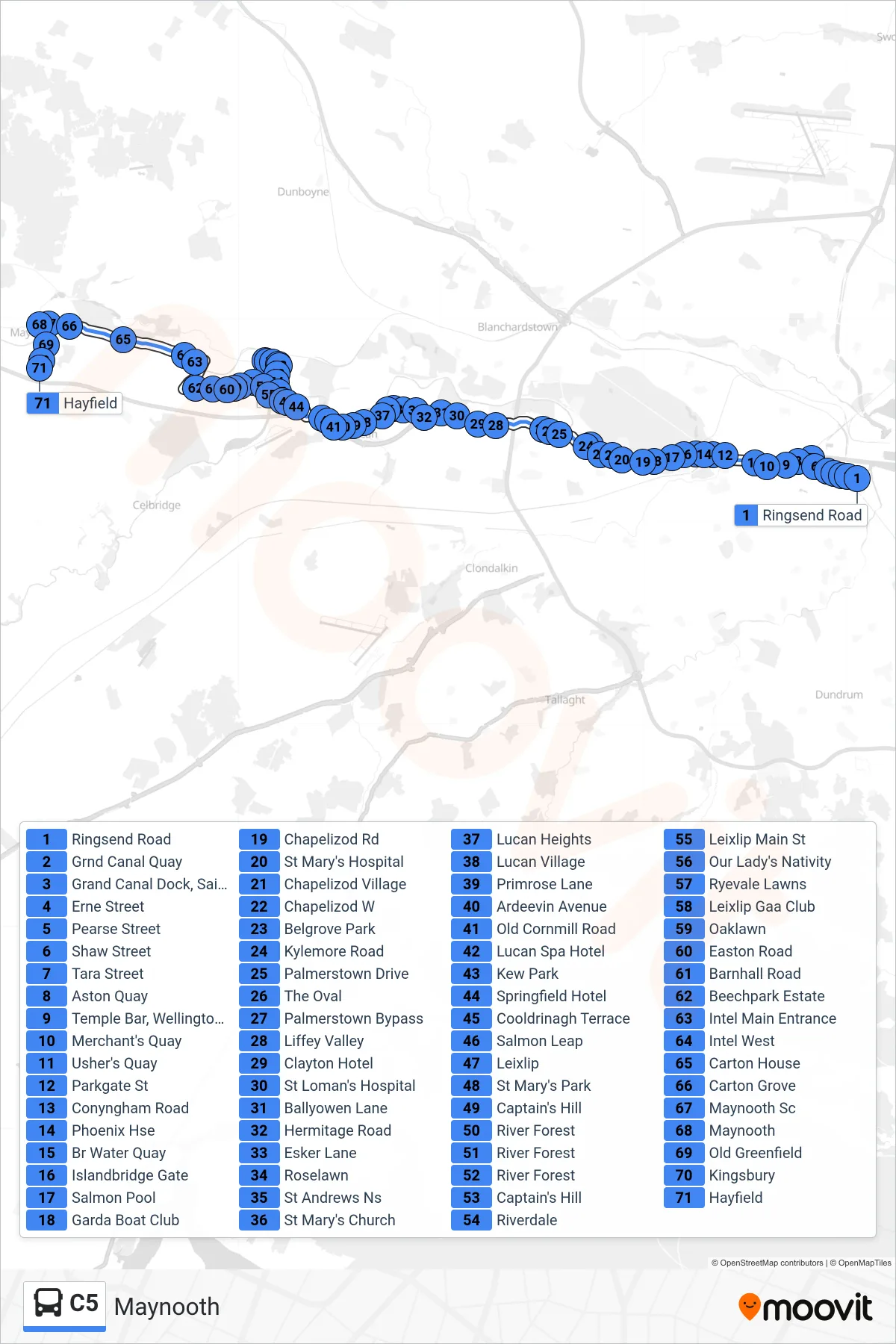
Stops list (C5 - Maynooth)
- Ringsend Road
- Grnd Canal Quay
- Grand Canal Dock, Saint Andrew's Resource Centre
- Erne Street
- Pearse Street
- Shaw Street
- Tara Street
- Aston Quay
- Temple Bar, Wellington Quay
- Merchant's Quay
- Usher's Quay
- Parkgate St
- Conyngham Road
- Phoenix Hse
- Br Water Quay
- Islandbridge Gate
- Salmon Pool
- Garda Boat Club
- Chapelizod Rd
- St Mary's Hospital
- Chapelizod Village
- Chapelizod W
- Belgrove Park
- Kylemore Road
- Palmerstown Drive
- The Oval
- Palmerstown Bypass
- Liffey Valley
- Clayton Hotel
- St Loman's Hospital
- Ballyowen Lane
- Hermitage Road
- Esker Lane
- Roselawn
- St Andrews Ns
- St Mary's Church
- Lucan Heights
- Lucan Village
- Primrose Lane
- Ardeevin Avenue
- Old Cornmill Road
- Lucan Spa Hotel
- Kew Park
- Springfield Hotel
- Cooldrinagh Terrace
- Salmon Leap
- Leixlip
- St Mary's Park
- Captain's Hill
- River Forest
- River Forest
- River Forest
- Captain's Hill
- Riverdale
- Leixlip Main St
- Our Lady's Nativity
- Ryevale Lawns
- Leixlip Gaa Club
- Oaklawn
- Easton Road
- Barnhall Road
- Beechpark Estate
- Intel Main Entrance
- Intel West
- Carton House
- Carton Grove
- Maynooth Sc
- Maynooth
- Old Greenfield
- Kingsbury
- Hayfield