
C.FUORI Bus Route Map
View the C.FUORI route map and see all C.FUORI stops along the route. The map of C.FUORI shows where the bus travels and the location of each stop, making it easy to understand the entire route at a glance.
Explore L.Z. Rocca Priora Bus Services S.R.L. routes on the map and see where L.Z. Rocca Priora Bus Services S.R.L. bus services operate. Use the C.FUORI map to find bus stops and see how the C.FUORI connects different areas along its trip.
All C.FUORI stops on the map are displayed in route order, helping you follow the C.FUORI bus from the first stop to the last.
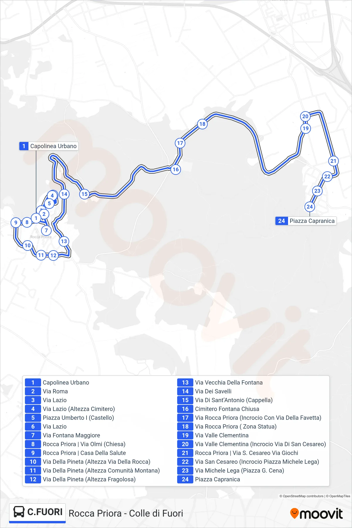
Stops list (C.FUORI - Colle Di Fuori)
- Urban Terminal
- Via Roma
- Lazio Street
- Lazio Street (Near Cemetery)
- Piazza Umberto I (Castle)
- Lazio Street
- Fontana Maggiore Street
- Rocca Priora | Via Olmi (Church)
- Rocca Priora | Health House
- Via Della Pineta (Near Via Della Rocca)
- Pine Grove Street (At Mountain Community)
- Pine Grove Road (At Fragolosa)
- Old Fountain Road
- Via Dei Savelli
- Sant'Antonio Street (Chapel)
- Fontana Chiusa Cemetery
- Rocca Priora Street (Junction with Favetta Street)
- Rocca Priora Street (Statue Area)
- Valle Clementina Street
- Valle Clementina St (San Cesareo St Intersection)
- Rocca Priora | San Cesareo Road Games Road
- San Cesareo Street (Michele Lega Square Intersection)
- Via Michele Lega (Piazza G. Cena)
- Capranica Square