
CGABLE Bus Route Map
View the CGABLE route map and see all CGABLE stops along the route. The map of CGABLE shows where the bus travels and the location of each stop, making it easy to understand the entire route at a glance.
Explore Miami-Dade Transit routes on the map and see where Miami-Dade Transit bus services operate. Use the CGABLE map to find bus stops and see how the CGABLE connects different areas along its trip.
All CGABLE stops on the map are displayed in route order, helping you follow the CGABLE bus from the first stop to the last.
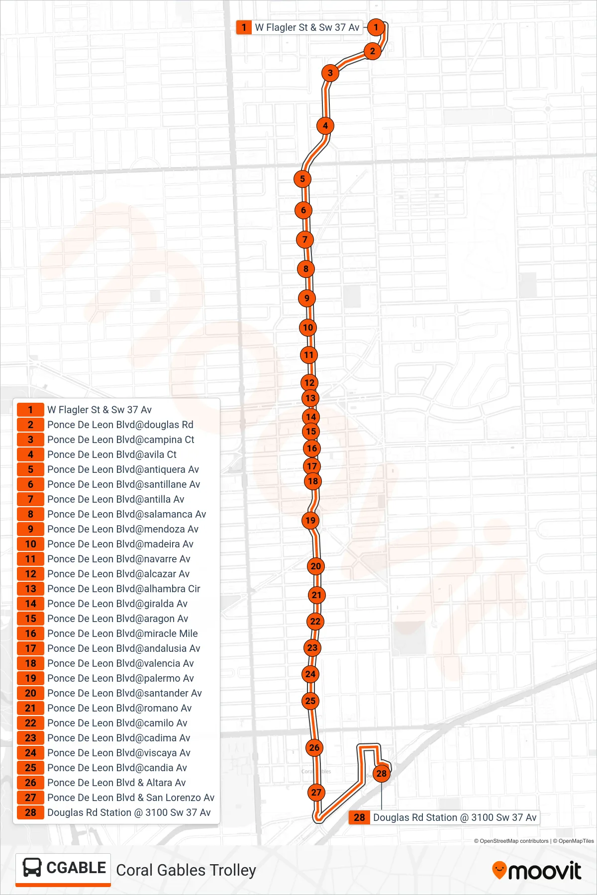
Stops list (CGABLE - Coral Gables Trolley)
- W Flagler St & Sw 37 Av
- Ponce De Leon Blvd@douglas Rd
- Ponce De Leon Blvd@campina Ct
- Ponce De Leon Blvd@avila Ct
- Ponce De Leon Blvd@antiquera Av
- Ponce De Leon Blvd@santillane Av
- Ponce De Leon Blvd@antilla Av
- Ponce De Leon Blvd@salamanca Av
- Ponce De Leon Blvd@mendoza Av
- Ponce De Leon Blvd@madeira Av
- Ponce De Leon Blvd@navarre Av
- Ponce De Leon Blvd@alcazar Av
- Ponce De Leon Blvd@alhambra Cir
- Ponce De Leon Blvd@giralda Av
- Ponce De Leon Blvd@aragon Av
- Ponce De Leon Blvd@miracle Mile
- Ponce De Leon Blvd@andalusia Av
- Ponce De Leon Blvd@valencia Av
- Ponce De Leon Blvd@palermo Av
- Ponce De Leon Blvd@santander Av
- Ponce De Leon Blvd@romano Av
- Ponce De Leon Blvd@camilo Av
- Ponce De Leon Blvd@cadima Av
- Ponce De Leon Blvd@viscaya Av
- Ponce De Leon Blvd@candia Av
- Ponce De Leon Blvd & Altara Av
- Ponce De Leon Blvd & San Lorenzo Av
- Douglas Rd Station @ 3100 Sw 37 Av