
CIUDAD -ROBLE Bus Route Map
View the CIUDAD -ROBLE route map and see all CIUDAD -ROBLE stops along the route. The map of CIUDAD -ROBLE shows where the bus travels and the location of each stop, making it easy to understand the entire route at a glance.
Explore Autobuses routes on the map and see where Autobuses bus services operate. Use the CIUDAD -ROBLE map to find bus stops and see how the CIUDAD -ROBLE connects different areas along its trip.
All CIUDAD -ROBLE stops on the map are displayed in route order, helping you follow the CIUDAD -ROBLE bus from the first stop to the last.
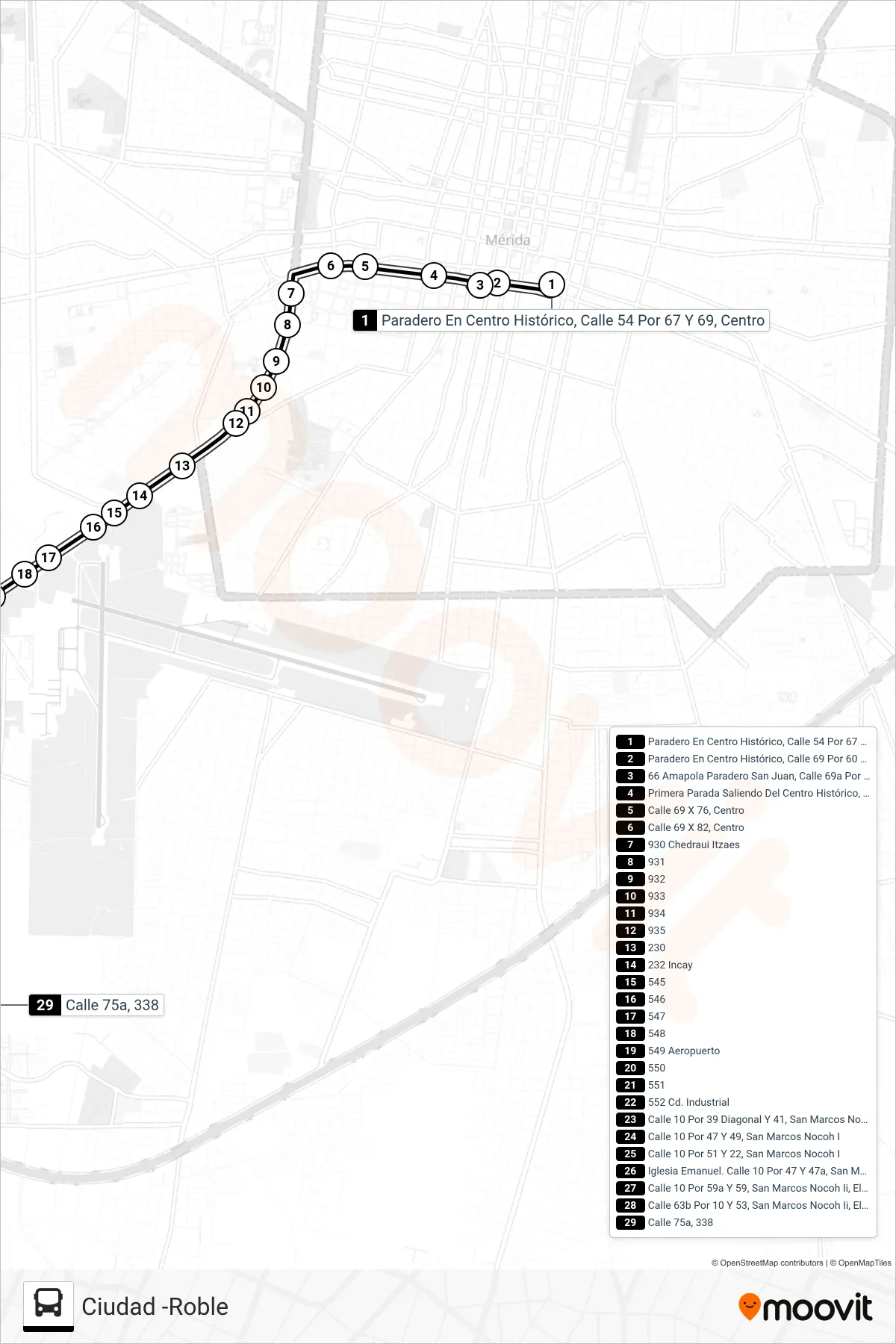
Stops list (CIUDAD -ROBLE - El Roble II)
- Paradero En Centro Histórico, Calle 54 Por 67 Y 69, Centro
- Paradero En Centro Histórico, Calle 69 Por 60 Y 62, Centro
- 66 Amapola Paradero San Juan, Calle 69a Por 62 Y 64, Centro
- Primera Parada Saliendo Del Centro Histórico, Calle 69 Por 68 Y 70, Centro
- Calle 69 X 76, Centro
- Calle 69 X 82, Centro
- 930 Chedraui Itzaes
- 931
- 932
- 933
- 934
- 935
- 230
- 232 Incay
- 545
- 546
- 547
- 548
- 549 Aeropuerto
- 550
- 551
- 552 Cd. Industrial
- Calle 10 Por 39 Diagonal Y 41, San Marcos Nocoh I
- Calle 10 Por 47 Y 49, San Marcos Nocoh I
- Calle 10 Por 51 Y 22, San Marcos Nocoh I
- Iglesia Emanuel. Calle 10 Por 47 Y 47a, San Marcos Nocoh Ii, El Roble Agrícola
- Calle 10 Por 59a Y 59, San Marcos Nocoh Ii, El Roble Agrícola
- Calle 63b Por 10 Y 53, San Marcos Nocoh Ii, El Roble Agrícola
- Calle 75a, 338