
CL Bus Route Map
View the CL route map and see all CL stops along the route. The map of CL shows where the bus travels and the location of each stop, making it easy to understand the entire route at a glance.
Explore Chapel Hill Transit routes on the map and see where Chapel Hill Transit bus services operate. Use the CL map to find bus stops and see how the CL connects different areas along its trip.
All CL stops on the map are displayed in route order, helping you follow the CL bus from the first stop to the last.
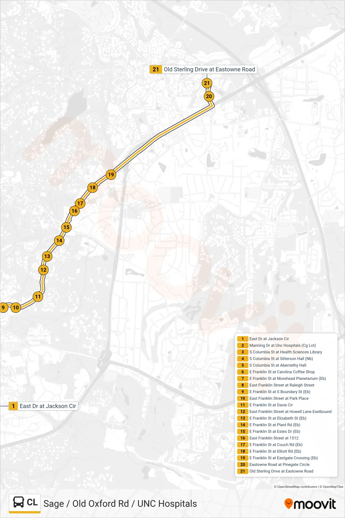
Stops list (CL - East Drive at Jackson Circle→Old Sterling Drive at Eastowne Road)
- East Dr at Jackson Cir
- Manning Dr at Unc Hospitals (Cg Lot)
- S Columbia St at Health Sciences Library
- S Columbia St at Sitterson Hall (Nb)
- S Columbia St at Abernethy Hall
- E Franklin St at Carolina Coffee Shop
- E Franklin St at Morehead Planetarium (Eb)
- East Franklin Street at Raleigh Street
- E Franklin St at S Boundary St (Eb)
- East Franklin Street at Park Place
- E Franklin St at Davie Cir
- East Franklin Street at Howell Lane Eastbound
- E Franklin St at Elizabeth St (Eb)
- E Franklin St at Plant Rd (Eb)
- E Franklin St at Estes Dr (Eb)
- East Franklin Street at 1512
- E Franklin St at Couch Rd (Eb)
- E Franklin St at Elliott Rd (Eb)
- E Franklin St at Eastgate Crossing (Eb)
- Eastowne Road at Pinegate Circle
- Old Sterling Drive at Eastowne Road