
COMBI Colectivo Route Map
View the COMBI route map and see all COMBI stops along the route. The map of COMBI shows where the Colectivo travels and the location of each stop, making it easy to understand the entire route at a glance.
Explore MercoBus routes on the map and see where MercoBus Colectivo services operate. Use the COMBI map to find Colectivo stops and see how the COMBI connects different areas along its trip.
All COMBI stops on the map are displayed in route order, helping you follow the COMBI Colectivo from the first stop to the last.
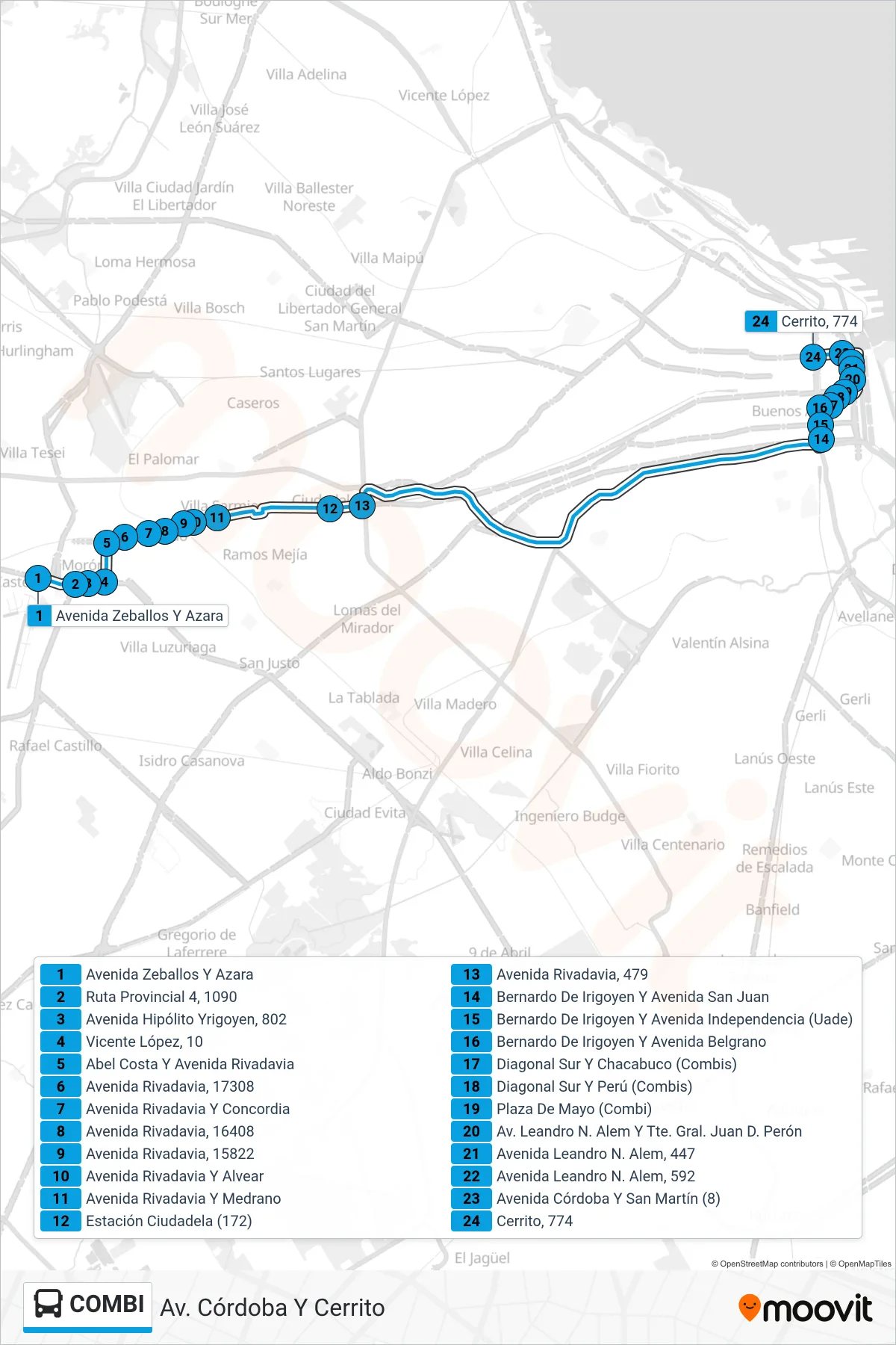
Stops list (COMBI - Av. Córdoba Y Cerrito)
- Avenida Zeballos Y Azara
- Ruta Provincial 4, 1090
- Avenida Hipólito Yrigoyen, 802
- Vicente López, 10
- Abel Costa Y Avenida Rivadavia
- Avenida Rivadavia, 17308
- Avenida Rivadavia Y Concordia
- Avenida Rivadavia, 16408
- Avenida Rivadavia, 15822
- Avenida Rivadavia Y Alvear
- Avenida Rivadavia Y Medrano
- Estación Ciudadela (172)
- Avenida Rivadavia, 479
- Bernardo De Irigoyen Y Avenida San Juan
- Bernardo De Irigoyen Y Avenida Independencia (Uade)
- Bernardo De Irigoyen Y Avenida Belgrano
- Diagonal Sur Y Chacabuco (Combis)
- Diagonal Sur Y Perú (Combis)
- Plaza De Mayo (Combi)
- Av. Leandro N. Alem Y Tte. Gral. Juan D. Perón
- Avenida Leandro N. Alem, 447
- Avenida Leandro N. Alem, 592
- Avenida Córdoba Y San Martín (8)
- Cerrito, 774
Change direction
- Route Map - COMBI - Ituzaingó (Mb4)
- Route Map - COMBI - Centro (Mb1)
- Route Map - COMBI - Parque Patricios
- Route Map - COMBI - Ituzaingó (Mb5)
- Route Map - COMBI - Centro (Mb4)
- Route Map - COMBI - Est. Ituzaingó (Mb1)
- Route Map - COMBI - Centro (Mb2)
- Route Map - COMBI - Av. Córdoba Y Cerrito (Mb3)
- Route Map - COMBI - Merlo (Mb3)