
COTRAL Bus Route Map
View the COTRAL route map and see all COTRAL stops along the route. The map of COTRAL shows where the bus travels and the location of each stop, making it easy to understand the entire route at a glance.
Explore Cotral routes on the map and see where Cotral bus services operate. Use the COTRAL map to find bus stops and see how the COTRAL connects different areas along its trip.
All COTRAL stops on the map are displayed in route order, helping you follow the COTRAL bus from the first stop to the last.
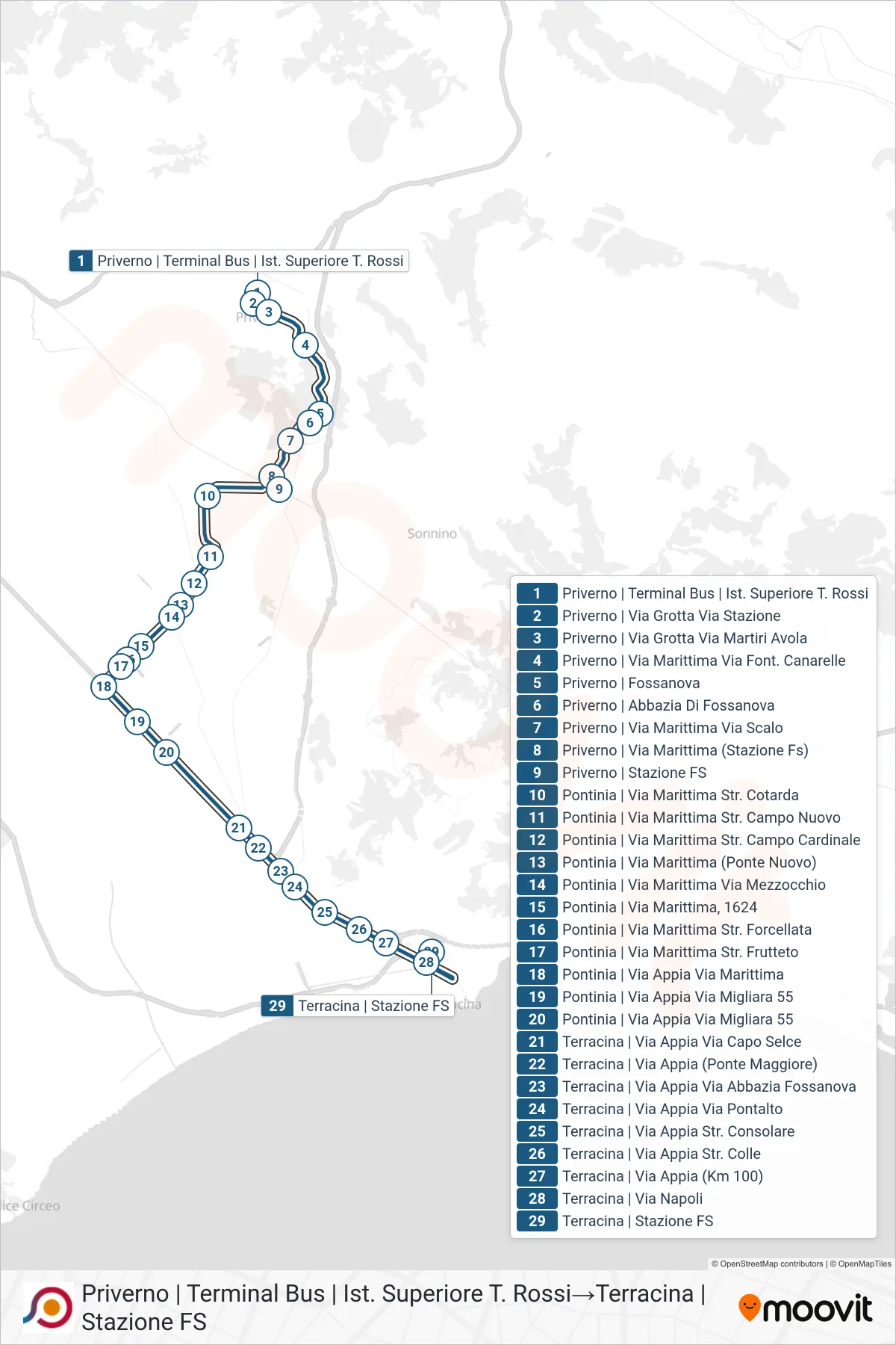
Stops list (COTRAL - Priverno | Bus Terminal | T. Rossi High School→Terracina Railway Station)
- Priverno | Bus Terminal | T. Rossi High School
- Priverno - Grotta Road Station Road
- Priverno | Grotta Street Martiri Avola Street
- Priverno | Maritime Road Canarelle Fountain
- Priverno | Fossanova
- Priverno | Fossanova Abbey
- Priverno | Maritime Road Railway Station
- Priverno | Maritime Road (Railway Station)
- Priverno | Railway Station
- Pontinia - Maritime Road Cotarda Street
- Pontinia | Maritime Street Campo Nuovo Road
- Pontinia | Via Marittima Cardinal Field Road
- Pontinia | Maritime Road (New Bridge)
- Pontinia | Maritime Street Mezzocchio Street
- Pontinia | Maritime Street, 1624
- Pontinia | Maritime Street Forcellata Road
- Pontinia - Maritime Road Orchard Street
- Pontinia | Appian Way Maritime Road
- Pontinia | Via Appia Migliara 55
- Pontinia | Via Appia Migliara 55
- Terracina | Appia Road Capo Selce Road
- Terracina - Via Appia (Main Bridge)
- Terracina | Appia Road Abbazia Fossanova Street
- Terracina | Appia Way Via Pontalto
- Terracina | Appia Road Consular Road
- Terracina | Appia Road Colle Street
- Terracina - Via Appia (Km 100)
- Terracina | Naples Street
- Terracina Railway Station