
COTRAL Bus Route Map
View the COTRAL route map and see all COTRAL stops along the route. The map of COTRAL shows where the bus travels and the location of each stop, making it easy to understand the entire route at a glance.
Explore Cotral routes on the map and see where Cotral bus services operate. Use the COTRAL map to find bus stops and see how the COTRAL connects different areas along its trip.
All COTRAL stops on the map are displayed in route order, helping you follow the COTRAL bus from the first stop to the last.
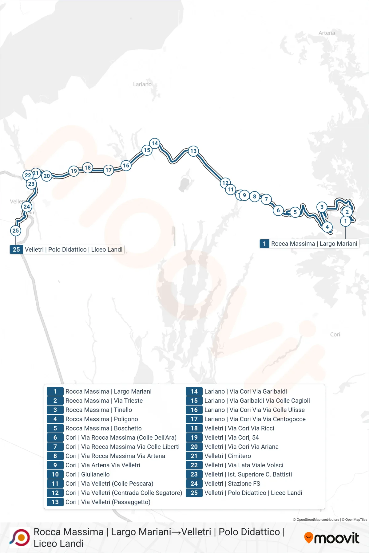
Stops list (COTRAL - Rocca Massima | Largo Mariani→Velletri | Educational Center | Landi High School)
- Rocca Massima | Largo Mariani
- Rocca Massima | Tinello
- Rocca Massima - Poligono
- Rocca Massima - Boschetto
- Cori | Via Rocca Massima (Colle Dell'Ara)
- Cori | Rocca Massima Street Colle Liberti Street
- Cori | Rocca Massima Street Artena Street
- Cori | Artena Street Velletri Street
- Cori Giulianello
- Cori | Velletri St (Colle Pescara)
- Cori | Velletri Street (Colle Segatore District)
- Cori | Velletri Road (Passaggetto)
- Via Cori Via Garibaldi - Lariano
- Lariano | Garibaldi Street Colle Cagioli Street
- Lariano | Cori Street Colle Ulisse Street
- Lariano | Cori Street Centogocce Street
- Velletri | Cori Street Ricci Street
- Velletri | Via Cori, 54
- Velletri | Via Cori Via Ariana
- Velletri | Cemetery
- Velletri | Via Lata Viale Volsci
- Velletri | C. Battisti High School
- Velletri Train Station
- Velletri | Educational Center | Landi High School