
COTRAL Bus Route Map
View the COTRAL route map and see all COTRAL stops along the route. The map of COTRAL shows where the bus travels and the location of each stop, making it easy to understand the entire route at a glance.
Explore Cotral routes on the map and see where Cotral bus services operate. Use the COTRAL map to find bus stops and see how the COTRAL connects different areas along its trip.
All COTRAL stops on the map are displayed in route order, helping you follow the COTRAL bus from the first stop to the last.
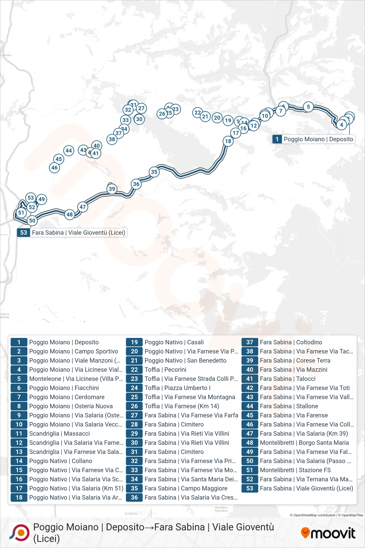
Stops list (COTRAL - Poggio Moiano Depot→Fara Sabina | Youth Avenue (High Schools))
- Poggio Moiano Depot
- Poggio Moiano | Sports Field
- Poggio Moiano | Manzoni Avenue (Schools)
- Poggio Moiano | Licinese Street Manzoni Avenue
- Monteleone | Via Licinese (Villa Pepoli)
- Poggio Moiano | Fiacchini
- Poggio Moiano - Cerdomare
- Poggio Moiano | Osteria Nuova
- Poggio Moiano via Salaria (Osteria Nuova)
- Poggio Moiano via Salaria Vecchia via Ulivi
- Scandriglia | Massacci
- Poggio Nativo | Collano
- Poggio Nativo | Salaria Road Scalette Street
- Poggio Nativo | Salaria Road (Km 51)
- Poggio Nativo | Salaria Road Archipiglione Road
- Toffia via Farnese via Mountain
- Fara Sabina | Cemetery
- Fara Sabina | Via Rieti Via Villini
- Fara Sabina via Farnese via Prime Case
- Fara Sabina | Coltodino
- Fara Sabina | Talocci
- Fara Sabina | Campo Maggiore
- Fara Sabina | Stallone
- Fara Sabina | Salaria Road Crescenzi Road
- Fara Sabina | Corese Terra
- Fara Sabina | Via Salaria (Km 39)
- Montelibretti | Borgo Santa Maria
- Fara Sabina | Salaria Road (Passo Corese)
- Montelibretti Station
- Fara Sabina | Ternana Road Matteotti Road
- Fara Sabina | Youth Avenue (High Schools)