
COTRAL Bus Route Map
View the COTRAL route map and see all COTRAL stops along the route. The map of COTRAL shows where the bus travels and the location of each stop, making it easy to understand the entire route at a glance.
Explore Cotral routes on the map and see where Cotral bus services operate. Use the COTRAL map to find bus stops and see how the COTRAL connects different areas along its trip.
All COTRAL stops on the map are displayed in route order, helping you follow the COTRAL bus from the first stop to the last.
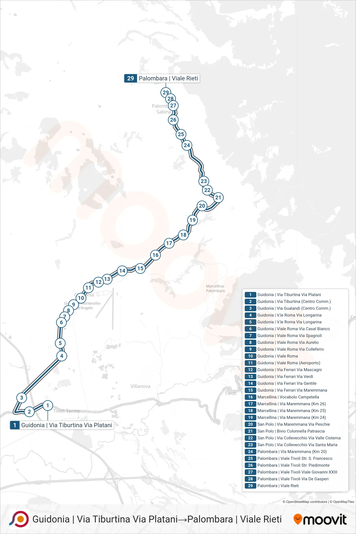
Stops list (COTRAL - Guidonia | Tiburtina Street Platani Street→Palombara via Viale Rieti)
- Guidonia | Tiburtina Street Platani Street
- Guidonia | Via Gualandi (Shopping Center)
- Guidonia | Roma Avenue Longarina Street
- Guidonia | Roma Avenue Longarina Street
- Guidonia | Roma Avenue Casal Bianco Road
- Guidonia | Viale Roma Via Spagnoli
- Guidonia | Roma Avenue Aurelio Street
- Guidonia | Viale Roma Via Colleferro
- Guidonia | Viale Roma
- Guidonia via Roma (Airport)
- Guidonia | Ferrari Street Mascagni Street
- Guidonia - Via Ferrari Via Verdi
- Ferrari Street - Gentile Street (Guidonia)
- Guidonia | Ferrari Road Maremmana Road
- Marcellina | Campetella Area
- Marcellina - Via Maremmana (Km 26)
- Marcellina | Maremmana Road (Km 25)
- Marcellina | Maremmana Road (Km 24)
- San Polo | Maremmana Road Peschie Road
- San Polo | Colonnella Patrascia Junction
- San Polo | Collevecchio Street Valley Cisterna
- San Polo | Collevecchio Street Santa Maria Street
- Palombara | Maremmana Road (Km 20)
- Palombara | Tivoli Avenue St. Francis Street
- Palombara | Tivoli Avenue Piedimonte Street
- Palombara | Viale Tivoli Viale Giovanni XXIII
- Palombara | Tivoli Avenue De Gasperi Street
- Palombara via Viale Rieti