
COTRAL Bus Route Map
View the COTRAL route map and see all COTRAL stops along the route. The map of COTRAL shows where the bus travels and the location of each stop, making it easy to understand the entire route at a glance.
Explore Cotral routes on the map and see where Cotral bus services operate. Use the COTRAL map to find bus stops and see how the COTRAL connects different areas along its trip.
All COTRAL stops on the map are displayed in route order, helping you follow the COTRAL bus from the first stop to the last.
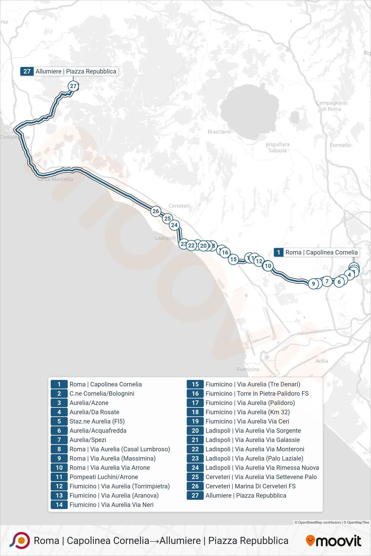
Stops list (COTRAL - Rome | Cornelia Terminal→Allumiere | Piazza Repubblica)
- Rome | Cornelia Terminal
- Cornelia Circle/Bolognini
- Aurelia/Azone
- Aurelia/Da Rosate
- Aurelia Station (Fl5)
- Aurelia/Acquafredda
- Aurelia/Spezi
- Rome | Aurelia Road (Casal Lumbroso)
- Rome | Via Aurelia (Massimina)
- Roma | Via Aurelia Via Arrone
- Pompeati Luchini/Arrone
- Fiumicino | Aurelia Road (Torrimpietra)
- Fiumicino | Aurelia Street (Aranova)
- Fiumicino | Aurelia Street Neri Street
- Fiumicino via Aurelia (Tre Denari)
- Fiumicino | Torre In Pietra-Palidoro Station
- Fiumicino via Aurelia (Palidoro)
- Fiumicino | Aurelia Street (Km 32)
- Fiumicino | Aurelia Road Ceri Road
- Ladispoli | Aurelia Road Sorgente Street
- Ladispoli | Aurelia Road Galassie Road
- Ladispoli - Aurelia Road Monteroni
- Ladispoli | Aurelia Road (Palo Laziale)
- Ladispoli | Aurelia Road Rimessa Nuova
- Cerveteri | Aurelia Street Settevene Palo Street
- Cerveteri | Marina Di Cerveteri Station
- Allumiere | Piazza Repubblica