
COTRAL Bus Route Map
View the COTRAL route map and see all COTRAL stops along the route. The map of COTRAL shows where the bus travels and the location of each stop, making it easy to understand the entire route at a glance.
Explore Cotral routes on the map and see where Cotral bus services operate. Use the COTRAL map to find bus stops and see how the COTRAL connects different areas along its trip.
All COTRAL stops on the map are displayed in route order, helping you follow the COTRAL bus from the first stop to the last.
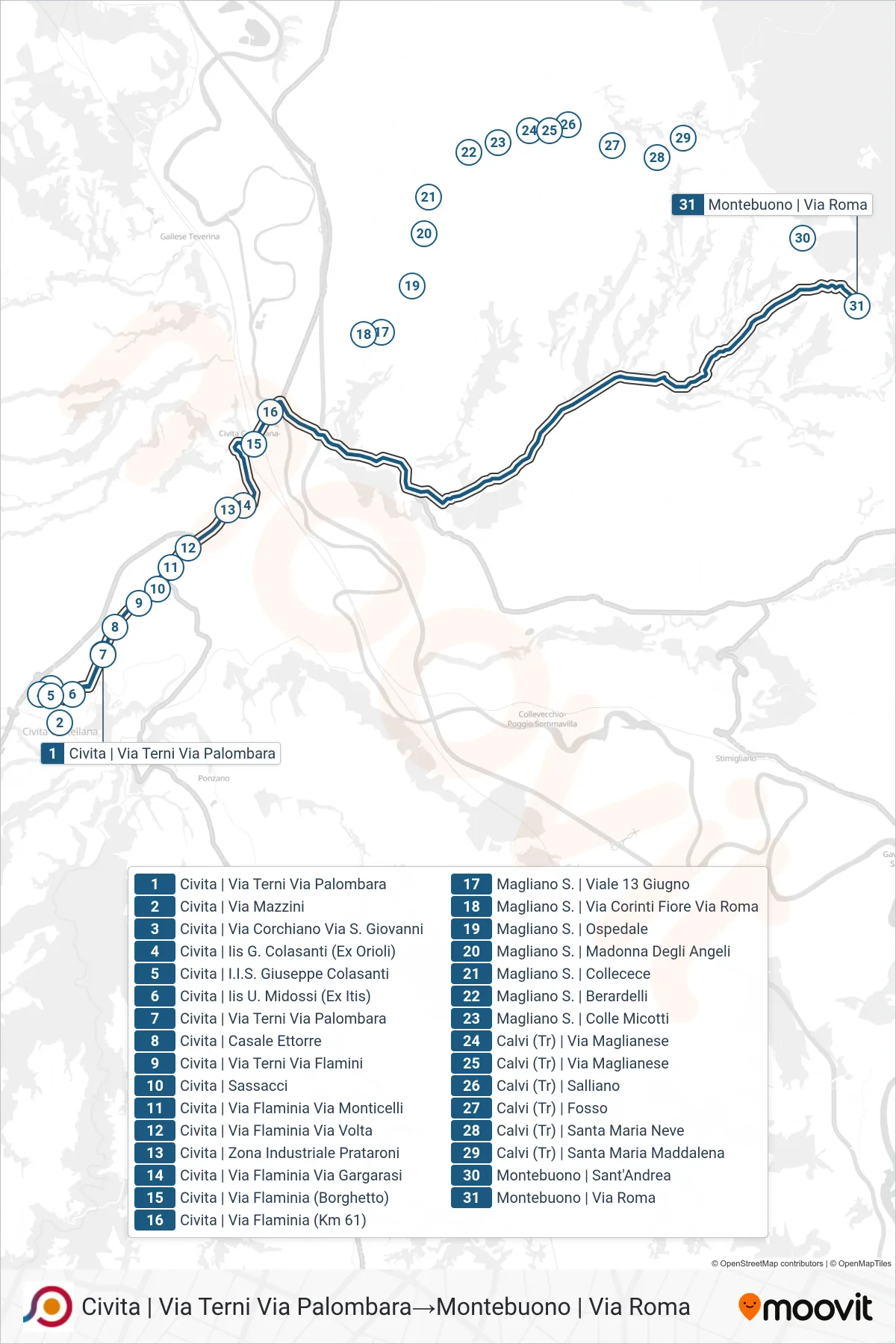
Stops list (COTRAL - Civita via Terni via Palombara→Montebuono via Roma)
- Civita via Terni via Palombara
- Civita | Mazzini Street
- Civita - Via Corchiano Via St. Giovanni
- Civita to IIS G. Colasanti (Ex Orioli)
- Civita | Giuseppe Colasanti Institute
- Civita | U. Midossi Institute (Ex Technical)
- Civita via Terni via Palombara
- Civita | Ettorre Farmhouse
- Civita | Via Terni Via Flamini
- Civita - Sassacci
- Civita | Flaminia Street Via Monticelli
- Civita | Flaminia Street Volta Street
- Civita | Prataroni Industrial Zone
- Civita | Flaminia Street Gargarasi Street
- Civita | Flaminia Street (Borghetto)
- Civita | Flaminian Way (Km 61)
- Magliano S. | 13 June Avenue
- Magliano S. | Via Corinti Fiore Via Roma
- Magliano S. | Hospital
- Magliano S. | Madonna of the Angels
- Magliano Sabina | Collecece
- Magliano S. | Berardelli
- Magliano S. | Colle Micotti
- Calvi | Maglianese Road
- Calvi | Maglianese Road
- Calvi | Salliano
- Calvi (TR) - Fosso
- Calvi | Santa Maria Neve
- Calvi | Saint Mary Magdalene
- Montebuono | Saint Andrew
- Montebuono via Roma