
COTRAL Bus Route Map
View the COTRAL route map and see all COTRAL stops along the route. The map of COTRAL shows where the bus travels and the location of each stop, making it easy to understand the entire route at a glance.
Explore Cotral routes on the map and see where Cotral bus services operate. Use the COTRAL map to find bus stops and see how the COTRAL connects different areas along its trip.
All COTRAL stops on the map are displayed in route order, helping you follow the COTRAL bus from the first stop to the last.
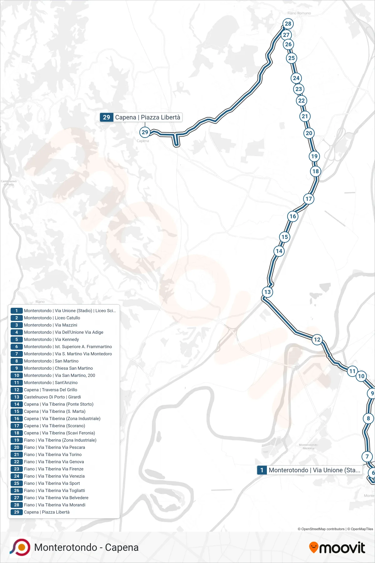
Stops list (COTRAL - Monterotondo Via Unione (Stadium) G.Peano Scientific High School→Capena | Liberty Square)
- Monterotondo Via Unione (Stadium) G.Peano Scientific High School
- Monterotondo via Catullo High School
- Monterotondo - Via Mazzini
- Monterotondo | Via Dell'Unione Via Adige
- Monterotondo | Kennedy Street
- Monterotondo | Frammartino High School
- Monterotondo | San Martino Road Montedoro Road
- Monterotondo | San Martino
- Monterotondo | San Martino Church
- Monterotondo | Via San Martino, 200
- Monterotondo | Sant'Anzino
- Capena | Del Grillo Crossing
- Castelnuovo Di Porto via Girardi
- Capena | Tiberina Road (Ponte Storto)
- Capena | Tiber Street (St. Martha)
- Capena | Tiberina Road (Industrial Zone)
- Capena | Tiberina Street (Scorano)
- Capena | Via Tiberina (Feronia Excavations)
- Fiano | Tiberina Street (Industrial Zone)
- Fiano | Tiberina Road Pescara Road
- Fiano | Via Tiberina Via Torino
- Fiano | Via Tiberina Via Genova
- Fiano | Tiberina Street Florence Street
- Fiano | Tiberina Road Venice Road
- Fiano | Tiber Street Sport Street
- Fiano | Tiberina Road Togliatti Road
- Fiano - Via Tiberina Via Belvedere
- Fiano via Tiberina via Morandi
- Capena | Liberty Square