
CR27 Bus Route Map
View the CR27 route map and see all CR27 stops along the route. The map of CR27 shows where the bus travels and the location of each stop, making it easy to understand the entire route at a glance.
Explore Consorcio Grupo Uvita routes on the map and see where Consorcio Grupo Uvita bus services operate. Use the CR27 map to find bus stops and see how the CR27 connects different areas along its trip.
All CR27 stops on the map are displayed in route order, helping you follow the CR27 bus from the first stop to the last.
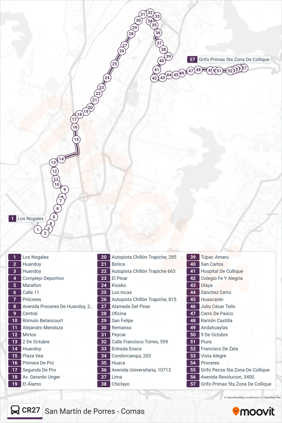
Stops list (CR27 - S.M.P. - Comas)
- Los Nogales
- Huandoy
- Huandoy
- Complejo Deportivo
- Marañon
- Calle 11
- Próceres
- Avenida Proceres De Huandoy, 2022
- Central
- Rómulo Betancourt
- Alejandro Mendoza
- Mirtos
- 2 De Octubre
- Huandoy
- Plaza Vea
- Primera De Pro
- Segunda De Pro
- Av. Gerardo Unger
- El Álamo
- Autopista Chillón Trapiche, 285
- Botica
- Autopista Chillón Trapiche 663
- El Pinar
- Kiosko
- Los Incas
- Autopista Chillón Trapiche, 815
- Alameda Del Pinar
- Oficina
- San Felipe
- Remanso
- Peycar
- Calle Francisco Torres, 599
- Entrada Enace
- Condorcanqui, 203
- Huaca
- Avenida Universitaria, 10713
- Lima
- Chiclayo
- Túpac Amaru
- San Carlos
- Hospital De Collique
- Colegio Fe Y Alegría
- Olaya
- Sánchez Cerro
- Huascarán
- Julio César Tello
- Cerro De Pasco
- Ramón Castilla
- Andahuaylas
- 9 De Octubre
- Piura
- Francisco De Zela
- Vista Alegre
- Proceres
- Grifo Pecsa 5ta Zona De Collique
- Avenida Revolucion, 3400
- Grifo Primax 5ta Zona De Collique