
CRSN Bus Route Map
View the CRSN route map and see all CRSN stops along the route. The map of CRSN shows where the bus travels and the location of each stop, making it easy to understand the entire route at a glance.
Explore RTC RIDE routes on the map and see where RTC RIDE bus services operate. Use the CRSN map to find bus stops and see how the CRSN connects different areas along its trip.
All CRSN stops on the map are displayed in route order, helping you follow the CRSN bus from the first stop to the last.
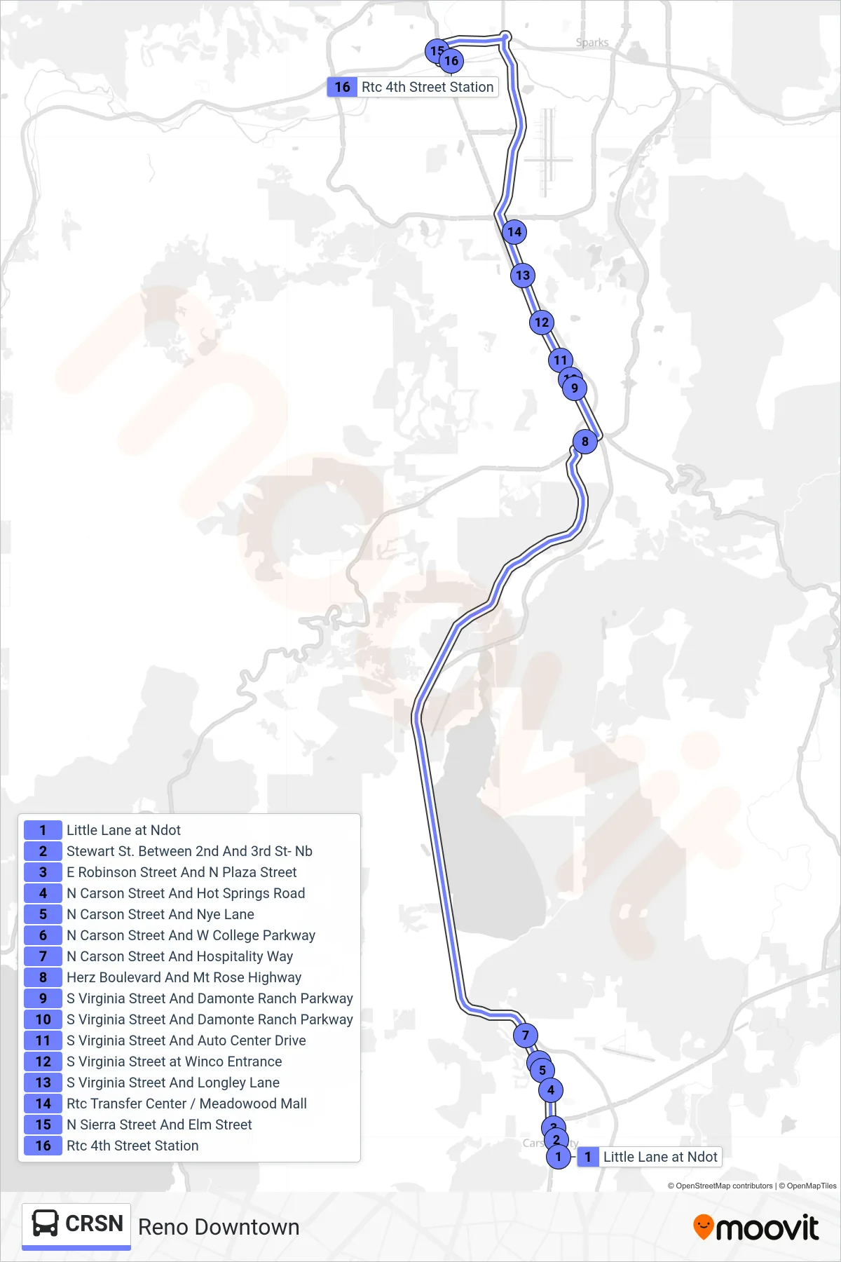
Stops list (CRSN - Reno Downtown)
- Little Lane at Ndot
- Stewart St. Between 2nd And 3rd St- Nb
- E Robinson Street And N Plaza Street
- N Carson Street And Hot Springs Road
- N Carson Street And Nye Lane
- N Carson Street And W College Parkway
- N Carson Street And Hospitality Way
- Herz Boulevard And Mt Rose Highway
- S Virginia Street And Damonte Ranch Parkway
- S Virginia Street And Damonte Ranch Parkway
- S Virginia Street And Auto Center Drive
- S Virginia Street at Winco Entrance
- S Virginia Street And Longley Lane
- Rtc Transfer Center / Meadowood Mall
- N Sierra Street And Elm Street
- Rtc 4th Street Station