
D Bus Route Map
View the D route map and see all D stops along the route. The map of D shows where the bus travels and the location of each stop, making it easy to understand the entire route at a glance.
Explore Chapel Hill Transit routes on the map and see where Chapel Hill Transit bus services operate. Use the D map to find bus stops and see how the D connects different areas along its trip.
All D stops on the map are displayed in route order, helping you follow the D bus from the first stop to the last.
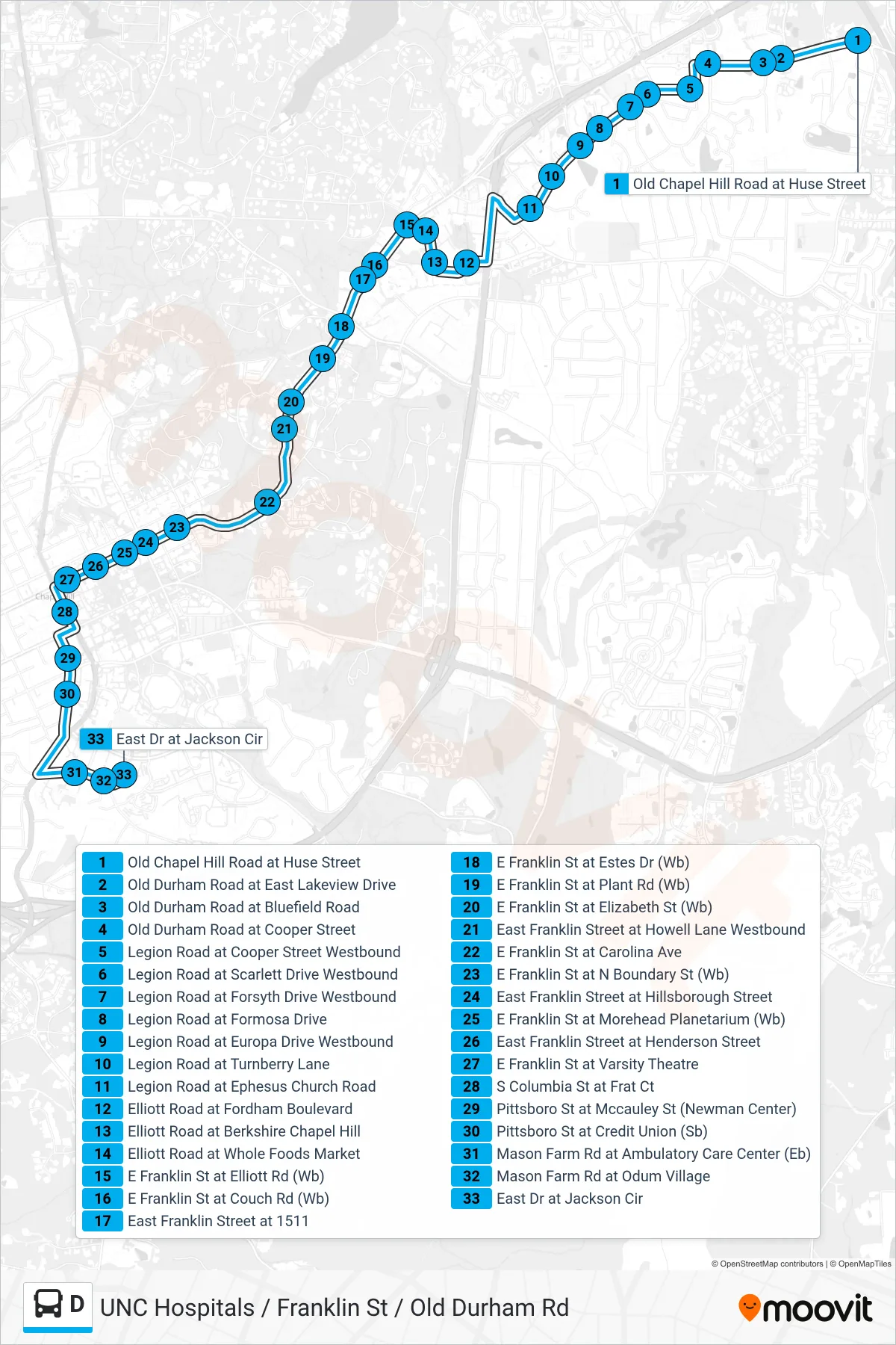
Stops list (D - Old Chapel Hill Road at Huse Street→East Drive at Jackson Circle)
- Old Chapel Hill Road at Huse Street
- Old Durham Road at East Lakeview Drive
- Old Durham Road at Bluefield Road
- Old Durham Road at Cooper Street
- Legion Road at Cooper Street Westbound
- Legion Road at Scarlett Drive Westbound
- Legion Road at Forsyth Drive Westbound
- Legion Road at Formosa Drive
- Legion Road at Europa Drive Westbound
- Legion Road at Turnberry Lane
- Legion Road at Ephesus Church Road
- Elliott Road at Fordham Boulevard
- Elliott Road at Berkshire Chapel Hill
- Elliott Road at Whole Foods Market
- E Franklin St at Elliott Rd (Wb)
- E Franklin St at Couch Rd (Wb)
- East Franklin Street at 1511
- E Franklin St at Estes Dr (Wb)
- E Franklin St at Plant Rd (Wb)
- E Franklin St at Elizabeth St (Wb)
- East Franklin Street at Howell Lane Westbound
- E Franklin St at Carolina Ave
- E Franklin St at N Boundary St (Wb)
- East Franklin Street at Hillsborough Street
- E Franklin St at Morehead Planetarium (Wb)
- East Franklin Street at Henderson Street
- E Franklin St at Varsity Theatre
- S Columbia St at Frat Ct
- Pittsboro St at Mccauley St (Newman Center)
- Pittsboro St at Credit Union (Sb)
- Mason Farm Rd at Ambulatory Care Center (Eb)
- Mason Farm Rd at Odum Village
- East Dr at Jackson Cir