
D10 Bus Route Map
View the D10 route map and see all D10 stops along the route. The map of D10 shows where the bus travels and the location of each stop, making it easy to understand the entire route at a glance.
Explore WMATA routes on the map and see where WMATA bus services operate. Use the D10 map to find bus stops and see how the D10 connects different areas along its trip.
All D10 stops on the map are displayed in route order, helping you follow the D10 bus from the first stop to the last.
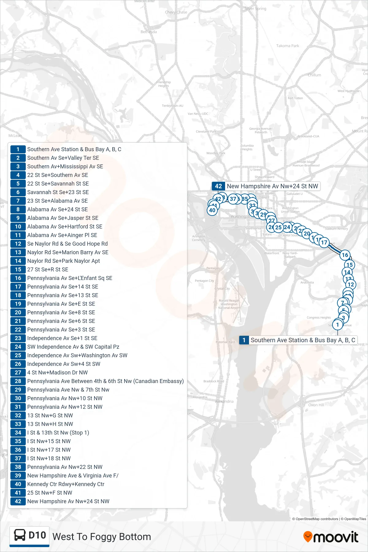
Stops list (D10 - West To Foggy Bottom)
- Southern Ave Station & Bus Bay A, B, C
- Southern Av Se+Valley Ter SE
- Southern Av+Mississippi Av SE
- 22 St Se+Southern Av SE
- 22 St Se+Savannah St SE
- Savannah St Se+23 St SE
- 23 St Se+Alabama Av SE
- Alabama Av Se+24 St SE
- Alabama Av Se+Jasper St SE
- Alabama Av Se+Hartford St SE
- Alabama Av Se+Ainger Pl SE
- Se Naylor Rd & Se Good Hope Rd
- Naylor Rd Se+Marion Barry Av SE
- Naylor Rd Se+Park Naylor Apt
- 27 St Se+R St SE
- Pennsylvania Av Se+L'Enfant Sq SE
- Pennsylvania Av Se+14 St SE
- Pennsylvania Av Se+13 St SE
- Pennsylvania Av Se+E St SE
- Pennsylvania Av Se+8 St SE
- Pennsylvania Av Se+6 St SE
- Pennsylvania Av Se+3 St SE
- Independence Av Se+1 St SE
- SW Independence Av & SW Capital Pz
- Independence Av Sw+Washington Av SW
- Independence Av Sw+4 St SW
- 4 St Nw+Madison Dr NW
- Pennsylvania Ave Between 4th & 6th St Nw (Canadian Embassy)
- Pennsylvania Ave Nw & 7th St Nw
- Pennsylvania Av Nw+10 St NW
- Pennsylvania Av Nw+12 St NW
- 13 St Nw+G St NW
- 13 St Nw+H St NW
- I St & 13th St Nw (Stop 1)
- I St Nw+15 St NW
- I St Nw+17 St NW
- I St Nw+18 St NW
- Pennsylvania Av Nw+22 St NW
- New Hampshire Ave & Virginia Ave F/
- Kennedy Ctr Rdwy+Kennedy Ctr
- 25 St Nw+F St NW
- New Hampshire Av Nw+24 St NW