
D36 Bus Route Map
View the D36 route map and see all D36 stops along the route. The map of D36 shows where the bus travels and the location of each stop, making it easy to understand the entire route at a glance.
Explore WMATA routes on the map and see where WMATA bus services operate. Use the D36 map to find bus stops and see how the D36 connects different areas along its trip.
All D36 stops on the map are displayed in route order, helping you follow the D36 bus from the first stop to the last.
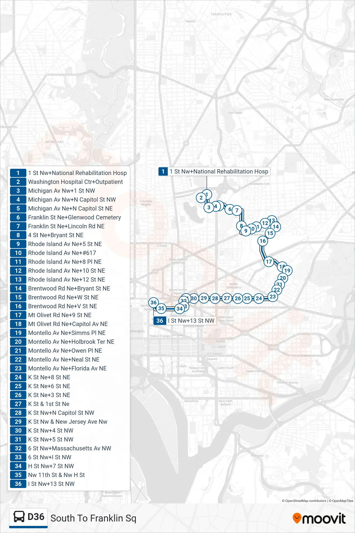
Stops list (D36 - South To Franklin Sq)
- 1 St Nw+National Rehabilitation Hosp
- Washington Hospital Ctr+Outpatient
- Michigan Av Nw+1 St NW
- Michigan Av Nw+N Capitol St NW
- Michigan Av Ne+N Capitol St NE
- Franklin St Ne+Glenwood Cemetery
- Franklin St Ne+Lincoln Rd NE
- 4 St Ne+Bryant St NE
- Rhode Island Av Ne+5 St NE
- Rhode Island Av Ne+#617
- Rhode Island Av Ne+8 Pl NE
- Rhode Island Av Ne+10 St NE
- Rhode Island Av Ne+12 St NE
- Brentwood Rd Ne+Bryant St NE
- Brentwood Rd Ne+W St NE
- Brentwood Rd Ne+V St NE
- Mt Olivet Rd Ne+9 St NE
- Mt Olivet Rd Ne+Capitol Av NE
- Montello Av Ne+Simms Pl NE
- Montello Av Ne+Holbrook Ter NE
- Montello Av Ne+Owen Pl NE
- Montello Av Ne+Neal St NE
- Montello Av Ne+Florida Av NE
- K St Ne+8 St NE
- K St Ne+6 St NE
- K St Ne+3 St NE
- K St & 1st St Ne
- K St Nw+N Capitol St NW
- K St Nw & New Jersey Ave Nw
- K St Nw+4 St NW
- K St Nw+5 St NW
- 6 St Nw+Massachusetts Av NW
- 6 St Nw+I St NW
- H St Nw+7 St NW
- Nw 11th St & Nw H St
- I St Nw+13 St NW