
D70 Bus Route Map
View the D70 route map and see all D70 stops along the route. The map of D70 shows where the bus travels and the location of each stop, making it easy to understand the entire route at a glance.
Explore WMATA routes on the map and see where WMATA bus services operate. Use the D70 map to find bus stops and see how the D70 connects different areas along its trip.
All D70 stops on the map are displayed in route order, helping you follow the D70 bus from the first stop to the last.
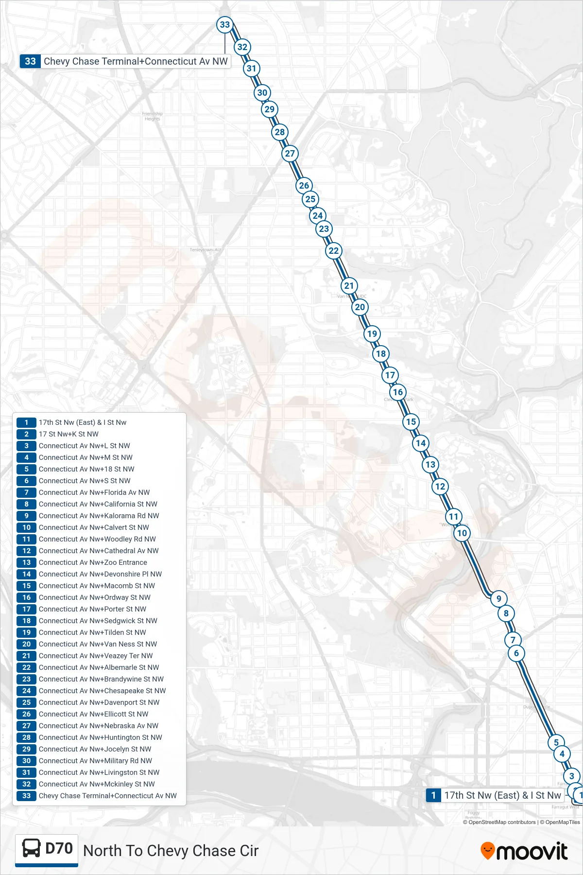
Stops list (D70 - North To Chevy Chase Cir)
- 17th St Nw (East) & I St Nw
- 17 St Nw+K St NW
- Connecticut Av Nw+L St NW
- Connecticut Av Nw+M St NW
- Connecticut Av Nw+18 St NW
- Connecticut Av Nw+S St NW
- Connecticut Av Nw+Florida Av NW
- Connecticut Av Nw+California St NW
- Connecticut Av Nw+Kalorama Rd NW
- Connecticut Av Nw+Calvert St NW
- Connecticut Av Nw+Woodley Rd NW
- Connecticut Av Nw+Cathedral Av NW
- Connecticut Av Nw+Zoo Entrance
- Connecticut Av Nw+Devonshire Pl NW
- Connecticut Av Nw+Macomb St NW
- Connecticut Av Nw+Ordway St NW
- Connecticut Av Nw+Porter St NW
- Connecticut Av Nw+Sedgwick St NW
- Connecticut Av Nw+Tilden St NW
- Connecticut Av Nw+Van Ness St NW
- Connecticut Av Nw+Veazey Ter NW
- Connecticut Av Nw+Albemarle St NW
- Connecticut Av Nw+Brandywine St NW
- Connecticut Av Nw+Chesapeake St NW
- Connecticut Av Nw+Davenport St NW
- Connecticut Av Nw+Ellicott St NW
- Connecticut Av Nw+Nebraska Av NW
- Connecticut Av Nw+Huntington St NW
- Connecticut Av Nw+Jocelyn St NW
- Connecticut Av Nw+Military Rd NW
- Connecticut Av Nw+Livingston St NW
- Connecticut Av Nw+Mckinley St NW
- Chevy Chase Terminal+Connecticut Av NW