
DLOOP1 Bus Route Map
View the DLOOP1 route map and see all DLOOP1 stops along the route. The map of DLOOP1 shows where the bus travels and the location of each stop, making it easy to understand the entire route at a glance.
Explore Miami-Dade Transit routes on the map and see where Miami-Dade Transit bus services operate. Use the DLOOP1 map to find bus stops and see how the DLOOP1 connects different areas along its trip.
All DLOOP1 stops on the map are displayed in route order, helping you follow the DLOOP1 bus from the first stop to the last.
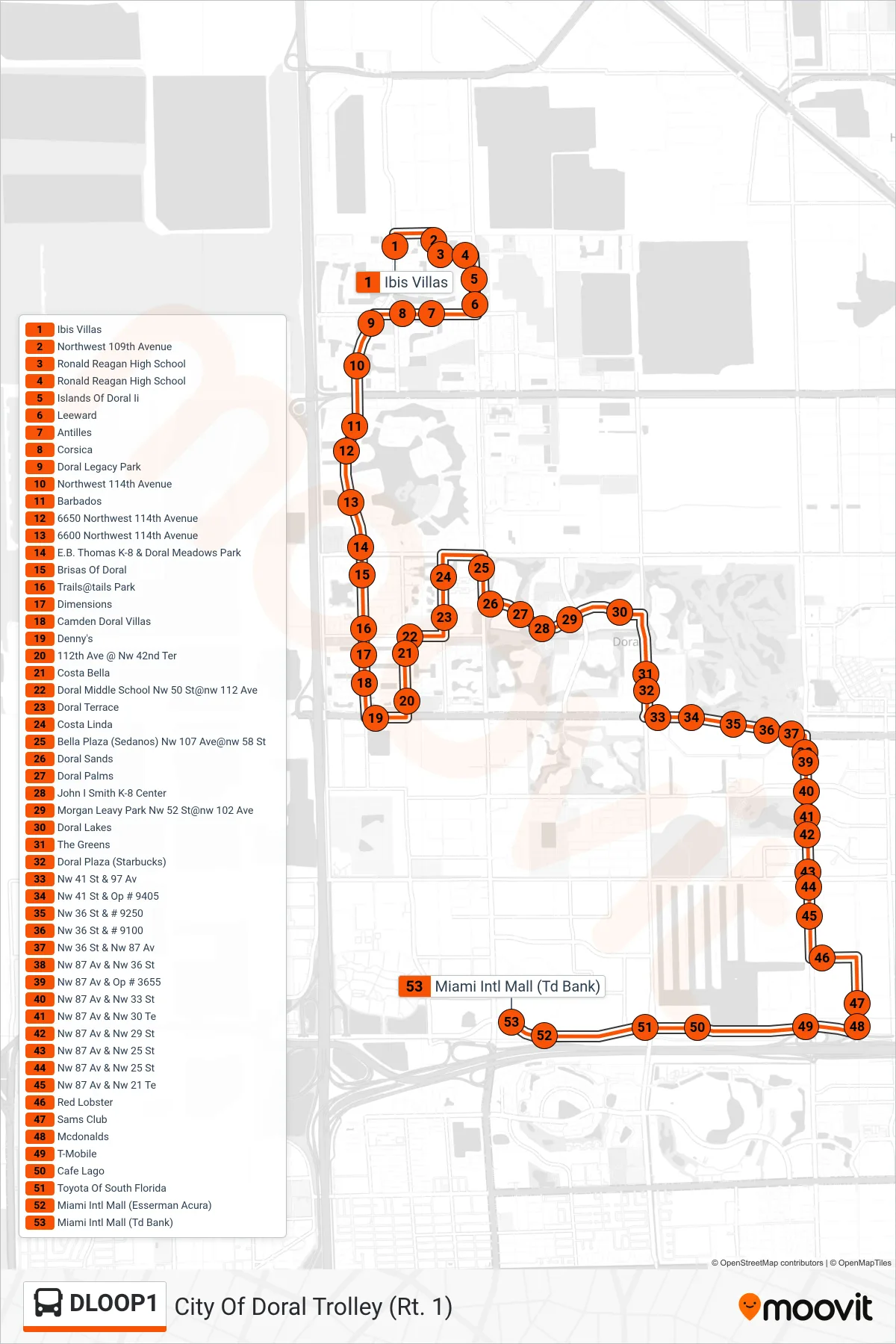
Stops list (DLOOP1 - City Of Doral Trolley (Rt. 1))
- Ibis Villas
- Northwest 109th Avenue
- Ronald Reagan High School
- Ronald Reagan High School
- Islands Of Doral Ii
- Leeward
- Antilles
- Corsica
- Doral Legacy Park
- Northwest 114th Avenue
- Barbados
- 6650 Northwest 114th Avenue
- 6600 Northwest 114th Avenue
- E.B. Thomas K-8 & Doral Meadows Park
- Brisas Of Doral
- Trails@tails Park
- Dimensions
- Camden Doral Villas
- Denny's
- 112th Ave @ Nw 42nd Ter
- Costa Bella
- Doral Middle School Nw 50 St@nw 112 Ave
- Doral Terrace
- Costa Linda
- Bella Plaza (Sedanos) Nw 107 Ave@nw 58 St
- Doral Sands
- Doral Palms
- John I Smith K-8 Center
- Morgan Leavy Park Nw 52 St@nw 102 Ave
- Doral Lakes
- The Greens
- Doral Plaza (Starbucks)
- Nw 41 St & 97 Av
- Nw 41 St & Op # 9405
- Nw 36 St & # 9250
- Nw 36 St & # 9100
- Nw 36 St & Nw 87 Av
- Nw 87 Av & Nw 36 St
- Nw 87 Av & Op # 3655
- Nw 87 Av & Nw 33 St
- Nw 87 Av & Nw 30 Te
- Nw 87 Av & Nw 29 St
- Nw 87 Av & Nw 25 St
- Nw 87 Av & Nw 25 St
- Nw 87 Av & Nw 21 Te
- Red Lobster
- Sams Club
- Mcdonalds
- T-Mobile
- Cafe Lago
- Toyota Of South Florida
- Miami Intl Mall (Esserman Acura)
- Miami Intl Mall (Td Bank)