
E Light Rail Route Map
View the E route map and see all E stops along the route. The map of E shows where the light rail travels and the location of each stop, making it easy to understand the entire route at a glance.
Explore Regional Transportation District routes on the map and see where Regional Transportation District light rail services operate. Use the E map to find light rail stations and see how the E connects different areas along its trip.
All E stops on the map are displayed in route order, helping you follow the E light rail from the first station to the last.
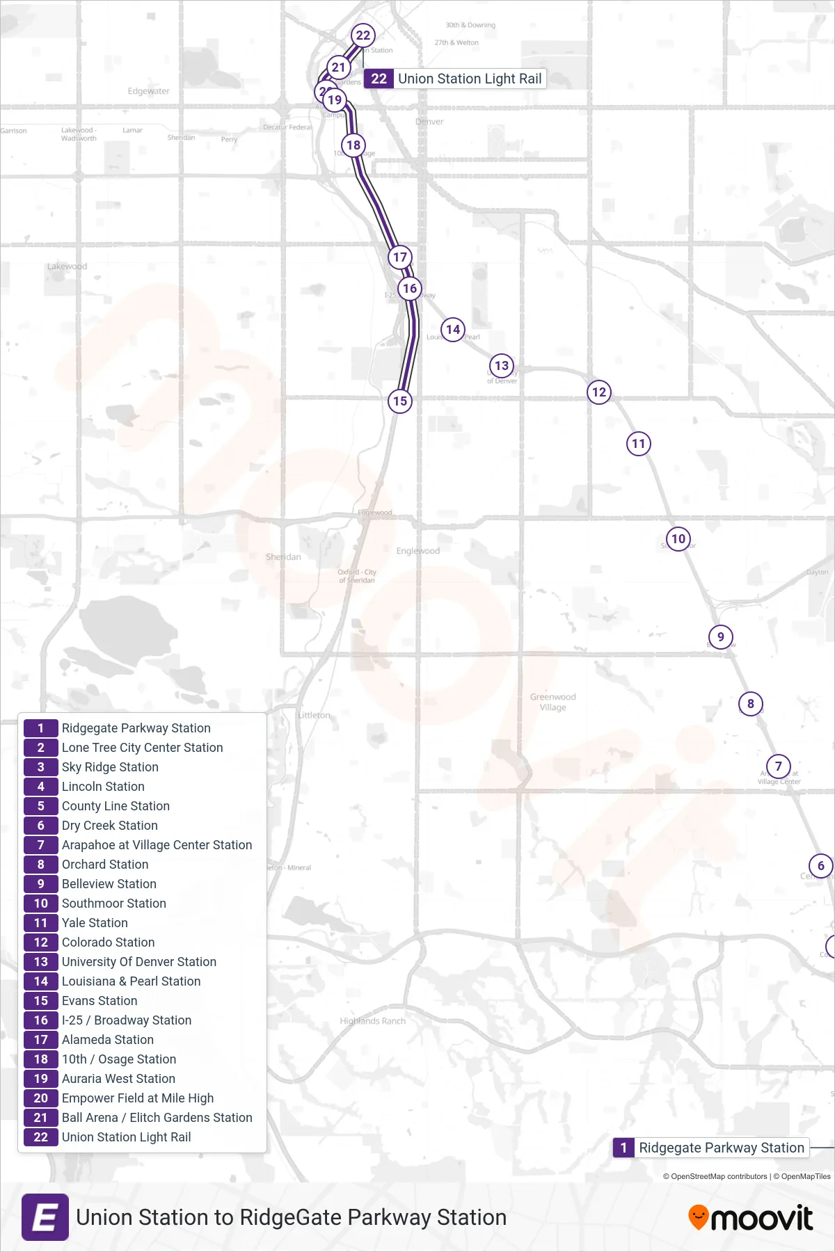
Stops list (E - Union Station)
- Ridgegate Parkway Station
- Lone Tree City Center Station
- Sky Ridge Station
- Lincoln Station
- County Line Station
- Dry Creek Station
- Arapahoe at Village Center Station
- Orchard Station
- Belleview Station
- Southmoor Station
- Yale Station
- Colorado Station
- University Of Denver Station
- Louisiana & Pearl Station
- Evans Station
- I-25 / Broadway Station
- Alameda Station
- 10th / Osage Station
- Auraria West Station
- Empower Field at Mile High
- Ball Arena / Elitch Gardens Station
- Union Station Light Rail