
E Bus Route Map
View the E route map and see all E stops along the route. The map of E shows where the bus travels and the location of each stop, making it easy to understand the entire route at a glance.
Explore Capital Area Transit routes on the map and see where Capital Area Transit bus services operate. Use the E map to find bus stops and see how the E connects different areas along its trip.
All E stops on the map are displayed in route order, helping you follow the E bus from the first stop to the last.
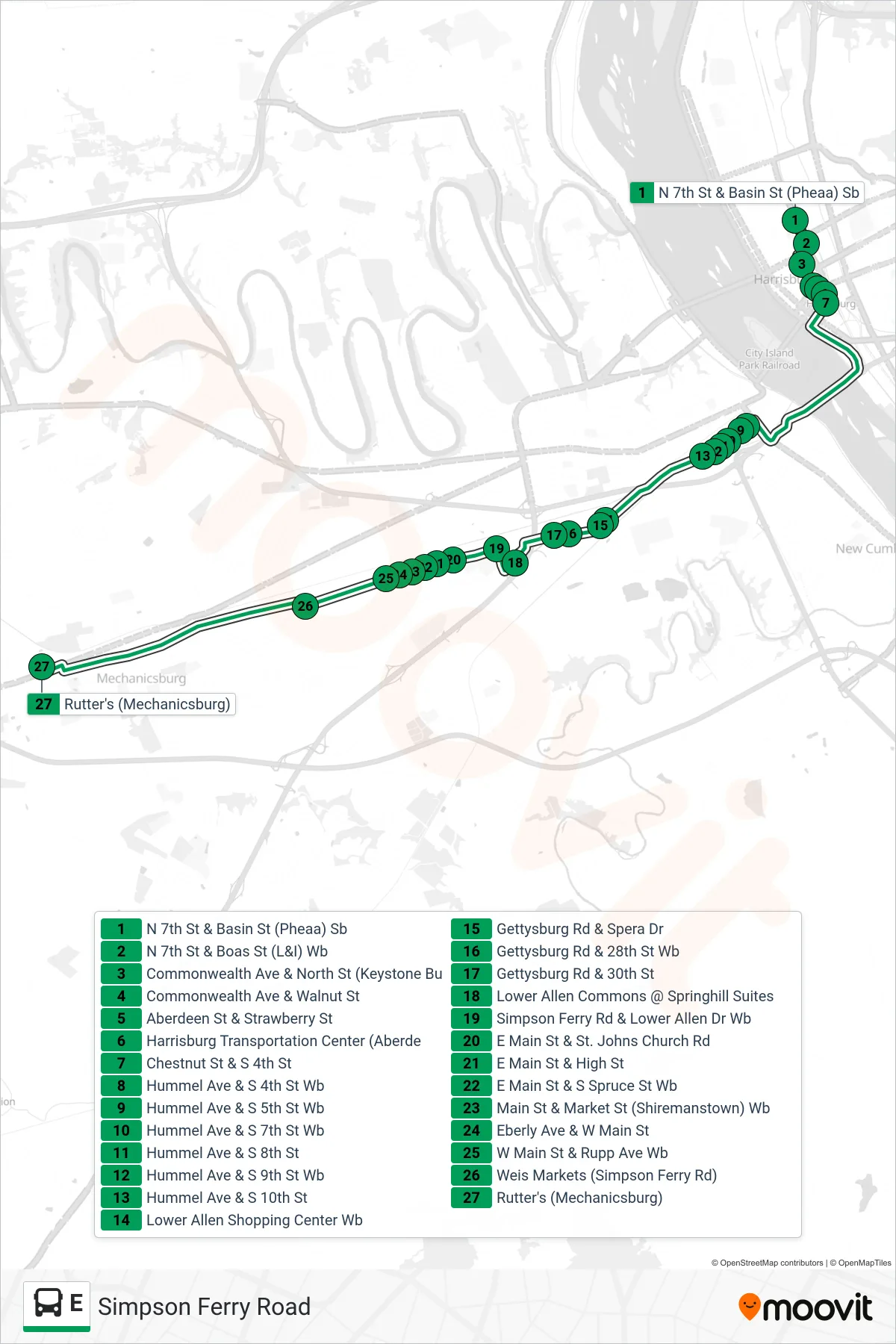
Stops list (E - E Mechanicsburg)
- N 7th St & Basin St (Pheaa) Sb
- N 7th St & Boas St (L&I) Wb
- Commonwealth Ave & North St (Keystone Bu
- Commonwealth Ave & Walnut St
- Aberdeen St & Strawberry St
- Harrisburg Transportation Center (Aberde
- Chestnut St & S 4th St
- Hummel Ave & S 4th St Wb
- Hummel Ave & S 5th St Wb
- Hummel Ave & S 7th St Wb
- Hummel Ave & S 8th St
- Hummel Ave & S 9th St Wb
- Hummel Ave & S 10th St
- Lower Allen Shopping Center Wb
- Gettysburg Rd & Spera Dr
- Gettysburg Rd & 28th St Wb
- Gettysburg Rd & 30th St
- Lower Allen Commons @ Springhill Suites
- Simpson Ferry Rd & Lower Allen Dr Wb
- E Main St & St. Johns Church Rd
- E Main St & High St
- E Main St & S Spruce St Wb
- Main St & Market St (Shiremanstown) Wb
- Eberly Ave & W Main St
- W Main St & Rupp Ave Wb
- Weis Markets (Simpson Ferry Rd)
- Rutter's (Mechanicsburg)