
E Bus Route Map
View the E route map and see all E stops along the route. The map of E shows where the bus travels and the location of each stop, making it easy to understand the entire route at a glance.
Explore Mainzer Mobilität routes on the map and see where Mainzer Mobilität bus services operate. Use the E map to find bus stops and see how the E connects different areas along its trip.
All E stops on the map are displayed in route order, helping you follow the E bus from the first stop to the last.
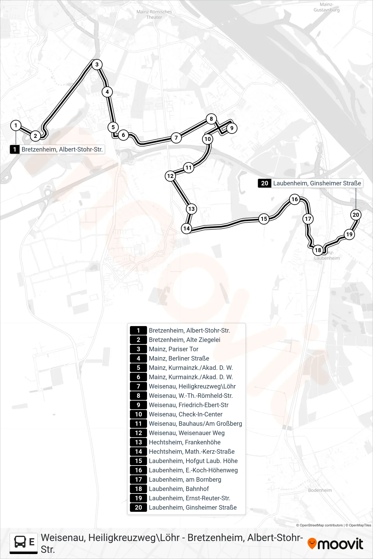
Stops list (E - Laubenheim, Ginsheimer Straße)
- Bretzenheim, Albert-Stohr-Str.
- Bretzenheim, Alte Ziegelei
- Mainz, Pariser Tor
- Mainz, Berliner Straße
- Mainz, Kurmainzk./Akad. D. W.
- Mainz, Kurmainzk./Akad. D. W.
- Weisenau, Heiligkreuzweg\Löhr
- Weisenau, W.-Th.-Römheld-Str.
- Weisenau, Friedrich-Ebert-Str
- Weisenau, Check-In-Center
- Weisenau, Bauhaus/Am Großberg
- Weisenau, Weisenauer Weg
- Hechtsheim, Frankenhöhe
- Hechtsheim, Math.-Kerz-Straße
- Laubenheim, Hofgut Laub. Höhe
- Laubenheim, E.-Koch-Höhenweg
- Laubenheim, am Bornberg
- Laubenheim, Bahnhof
- Laubenheim, Ernst-Reuter-Str.
- Laubenheim, Ginsheimer Straße
Change direction
- Route Map - E - Hauptbahnhof
- Route Map - E - Finthen
- Route Map - E - Igs Bretzenheim
- Route Map - E - Gonsenheim
- Route Map - E - Klein-Winternheim, Bahnhof
- Route Map - E - Bretzenheim
- Route Map - E - Finthen/Poststr.//Ü. Lerchenberg
- Route Map - E - Finthen, Römerquelle
- Route Map - E - Hartenberg
- Route Map - E - Mombach, Zwerchallee
- Route Map - E - Hauptbahnhof West
- Route Map - E - Laubenheim, Rüsselsheimer Alle
- Route Map - E - Bretzenheim, Albert-Stohr-Str.
- Route Map - E - Weisenau
- Route Map - E - Weisenau
- Route Map - E - Hechtsheim
- Route Map - E - Finthen
- Route Map - E - Mombach, Eintrachthalle
- Route Map - E - Mainz, Bismarckplatz
- Route Map - E - Weisenau, Heiligkreuzweg\Löhr