
E Bus Route Map
View the E route map and see all E stops along the route. The map of E shows where the bus travels and the location of each stop, making it easy to understand the entire route at a glance.
Explore Koblenzer Verkehrsbetriebe GmbH routes on the map and see where Koblenzer Verkehrsbetriebe GmbH bus services operate. Use the E map to find bus stops and see how the E connects different areas along its trip.
All E stops on the map are displayed in route order, helping you follow the E bus from the first stop to the last.
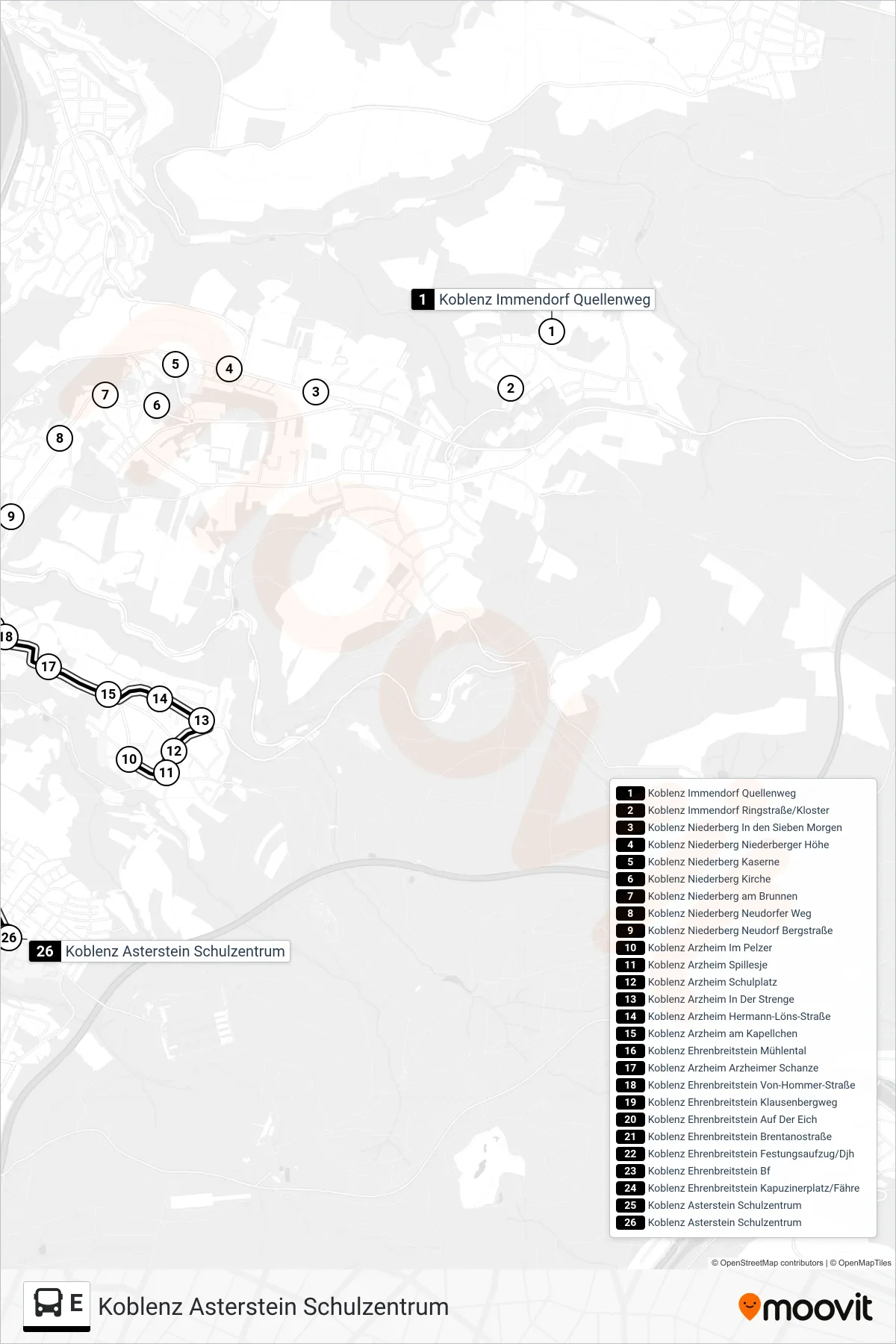
Stops list (E - Koblenz Asterstein Schulzentrum)
- Koblenz Immendorf Quellenweg
- Koblenz Immendorf Ringstraße/Kloster
- Koblenz Niederberg In den Sieben Morgen
- Koblenz Niederberg Niederberger Höhe
- Koblenz Niederberg Kaserne
- Koblenz Niederberg Kirche
- Koblenz Niederberg am Brunnen
- Koblenz Niederberg Neudorfer Weg
- Koblenz Niederberg Neudorf Bergstraße
- Koblenz Arzheim Im Pelzer
- Koblenz Arzheim Spillesje
- Koblenz Arzheim Schulplatz
- Koblenz Arzheim In Der Strenge
- Koblenz Arzheim Hermann-Löns-Straße
- Koblenz Arzheim am Kapellchen
- Koblenz Ehrenbreitstein Mühlental
- Koblenz Arzheim Arzheimer Schanze
- Koblenz Ehrenbreitstein Von-Hommer-Straße
- Koblenz Ehrenbreitstein Klausenbergweg
- Koblenz Ehrenbreitstein Auf Der Eich
- Koblenz Ehrenbreitstein Brentanostraße
- Koblenz Ehrenbreitstein Festungsaufzug/Djh
- Koblenz Ehrenbreitstein Bf
- Koblenz Ehrenbreitstein Kapuzinerplatz/Fähre
- Koblenz Asterstein Schulzentrum
- Koblenz Asterstein Schulzentrum
Change direction
- Route Map - E - Koblenz Immendorf Quellenweg
- Route Map - E - Koblenz Kesselheim Hwk-Ausbildungszentrum
- Route Map - E - Koblenz Hauptbahnhof
- Route Map - E - Koblenz Arenberg Pfarrer-Kraus-Straße
- Route Map - E - Koblenz Arenberg Pfarrer-Kraus-Straße
- Route Map - E - Koblenz Bahnhof Stadtmitte/Löhr-Center
- Route Map - E - Koblenz Karthause Hochschule/Schulzentrum
- Route Map - E - Koblenz Hauptbahnhof
- Route Map - E - Koblenz Wallersheim Deutschherrenstraße
- Route Map - E - Koblenz Moselweiß Bbs/Beatusstraße
- Route Map - E - Koblenz Lützel Igs Koblenz
- Route Map - E - Koblenz Metternich Universität
- Route Map - E - Koblenz Bahnhof Stadtmitte/Löhr-Center
- Route Map - E - Koblenz Zentralplatz/Forum
- Route Map - E - Koblenz Güls Kapelle
- Route Map - E - Koblenz Arzheim In Der Strenge