
E Bus Route Map
View the E route map and see all E stops along the route. The map of E shows where the bus travels and the location of each stop, making it easy to understand the entire route at a glance.
Explore Aachener Straßenbahn- und Energieversorgungs-AG routes on the map and see where Aachener Straßenbahn- und Energieversorgungs-AG bus services operate. Use the E map to find bus stops and see how the E connects different areas along its trip.
All E stops on the map are displayed in route order, helping you follow the E bus from the first stop to the last.
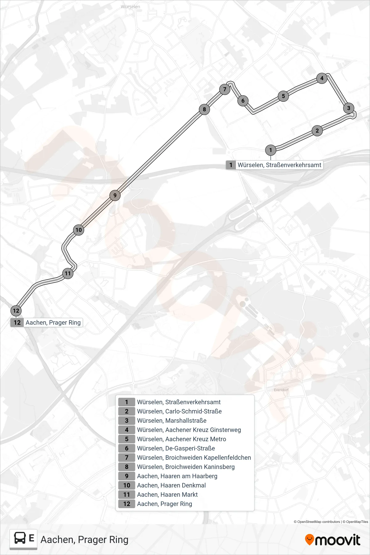
Stops list (E - Aachen, Prager Ring)
- Würselen, Straßenverkehrsamt
- Würselen, Carlo-Schmid-Straße
- Würselen, Marshallstraße
- Würselen, Aachener Kreuz Ginsterweg
- Würselen, Aachener Kreuz Metro
- Würselen, De-Gasperi-Straße
- Würselen, Broichweiden Kapellenfeldchen
- Würselen, Broichweiden Kaninsberg
- Aachen, Haaren am Haarberg
- Aachen, Haaren Denkmal
- Aachen, Haaren Markt
- Aachen, Prager Ring
Change direction
- Route Map - E - Aachen, Kaiserplatz
- Route Map - E - Schleckheim (Weiter Als Li. 65)
- Route Map - E - Aachen Im Brockenfeld
- Route Map - E - Uniklinik
- Route Map - E - Aachen, Bushof
- Route Map - E - Pascalstraße - Aachen Bushof
- Route Map - E - Eilendorf Schubertstraße
- Route Map - E - Süsterau
- Route Map - E - Schanz - Aachen Hauptbahnhof
- Route Map - E - Eilendorf Karlstraße
- Route Map - E - Hüls Elleter Feld
- Route Map - E - Aachen Forckenbeckstraße
- Route Map - E - Driescher Hof - Uniklinik