
E Bus Route Map
View the E route map and see all E stops along the route. The map of E shows where the bus travels and the location of each stop, making it easy to understand the entire route at a glance.
Explore Rheinbahn routes on the map and see where Rheinbahn bus services operate. Use the E map to find bus stops and see how the E connects different areas along its trip.
All E stops on the map are displayed in route order, helping you follow the E bus from the first stop to the last.
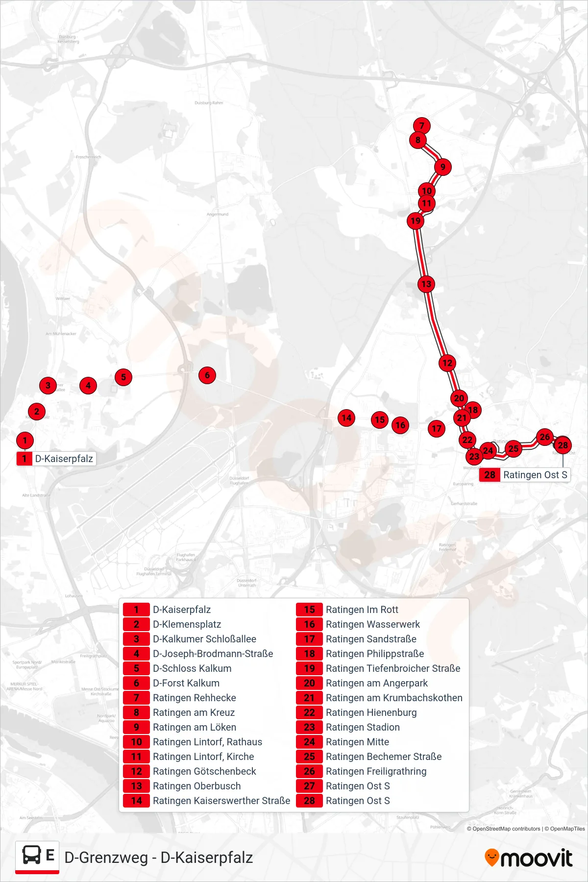
Stops list (E - Ratingen Ost S)
- D-Kaiserpfalz
- D-Klemensplatz
- D-Kalkumer Schloßallee
- D-Joseph-Brodmann-Straße
- D-Schloss Kalkum
- D-Forst Kalkum
- Ratingen Rehhecke
- Ratingen am Kreuz
- Ratingen am Löken
- Ratingen Lintorf, Rathaus
- Ratingen Lintorf, Kirche
- Ratingen Götschenbeck
- Ratingen Oberbusch
- Ratingen Kaiserswerther Straße
- Ratingen Im Rott
- Ratingen Wasserwerk
- Ratingen Sandstraße
- Ratingen Philippstraße
- Ratingen Tiefenbroicher Straße
- Ratingen am Angerpark
- Ratingen am Krumbachskothen
- Ratingen Hienenburg
- Ratingen Stadion
- Ratingen Mitte
- Ratingen Bechemer Straße
- Ratingen Freiligrathring
- Ratingen Ost S
- Ratingen Ost S
Change direction
- Route Map - E - Ratingen Hösel S
- Route Map - E - D-Schloss Kalkum
- Route Map - E - Duisburg Rahm Bf
- Route Map - E - Ratingen Lintorf, Rathaus
- Route Map - E - Ratingen Krummenweg
- Route Map - E - Ratingen Bechemer Straße
- Route Map - E - Ratingen Im Bruch
- Route Map - E - Ratingen Erfurter Straße
- Route Map - E - Ratingen Schumannsdieken
- Route Map - E - Ratingen am Kreuz
- Route Map - E - Ratingen am Kessel
- Route Map - E - Heiligenhaus Haus Karrenberg
- Route Map - E - Ratingen Nösenberg
- Route Map - E - Ratingen Lintorf, Friedhof
- Route Map - E - D-Kaiserpfalz
- Route Map - E - D-Am Fettpott
- Route Map - E - D-Kaiserpfalz
- Route Map - E - Ratingen Im Bruch
- Route Map - E - Ratingen Formerstraße
- Route Map - E - Ratingen am Rosenkothen
- Route Map - E - D-Grenzweg
- Route Map - E - D-Unterrath S
- Route Map - E - Ratingen Dieselstraße
- Route Map - E - Ratingen Ost S
- Route Map - E - Ratingen Markenbusch
- Route Map - E - D-Flughafen Bf
- Route Map - E - Ratingen Eggerscheidt
- Route Map - E - Ratingen Langenkamp
- Route Map - E - D-Klemensplatz
- Route Map - E - Ratingen Bergbusch
- Route Map - E - Ratingen Lintorf, Friedhof
- Route Map - E - Ratingen Mitte
- Route Map - E - Ratingen Lintorf, Kirche
- Route Map - E - Ratingen Gut Kost
- Route Map - E - Ratingen Lintorf, Rathaus
- Route Map - E - Ratingen Rehhecke
- Route Map - E - Ratingen Siemensstraße
- Route Map - E - Ratingen Heckenweg
- Route Map - E - Ratingen Rehhecke
- Route Map - E - D-Angeraue
- Route Map - E - Ratingen Brandenburger Straße
- Route Map - E - Ratingen Annastraße
- Route Map - E - Ratingen Hösel S
- Route Map - E - Ratingen Kirchfeldstraße
- Route Map - E - H'Haus In Der Blume/Stadtmitte