
E Bus Route Map
View the E route map and see all E stops along the route. The map of E shows where the bus travels and the location of each stop, making it easy to understand the entire route at a glance.
Explore Rheinbahn routes on the map and see where Rheinbahn bus services operate. Use the E map to find bus stops and see how the E connects different areas along its trip.
All E stops on the map are displayed in route order, helping you follow the E bus from the first stop to the last.
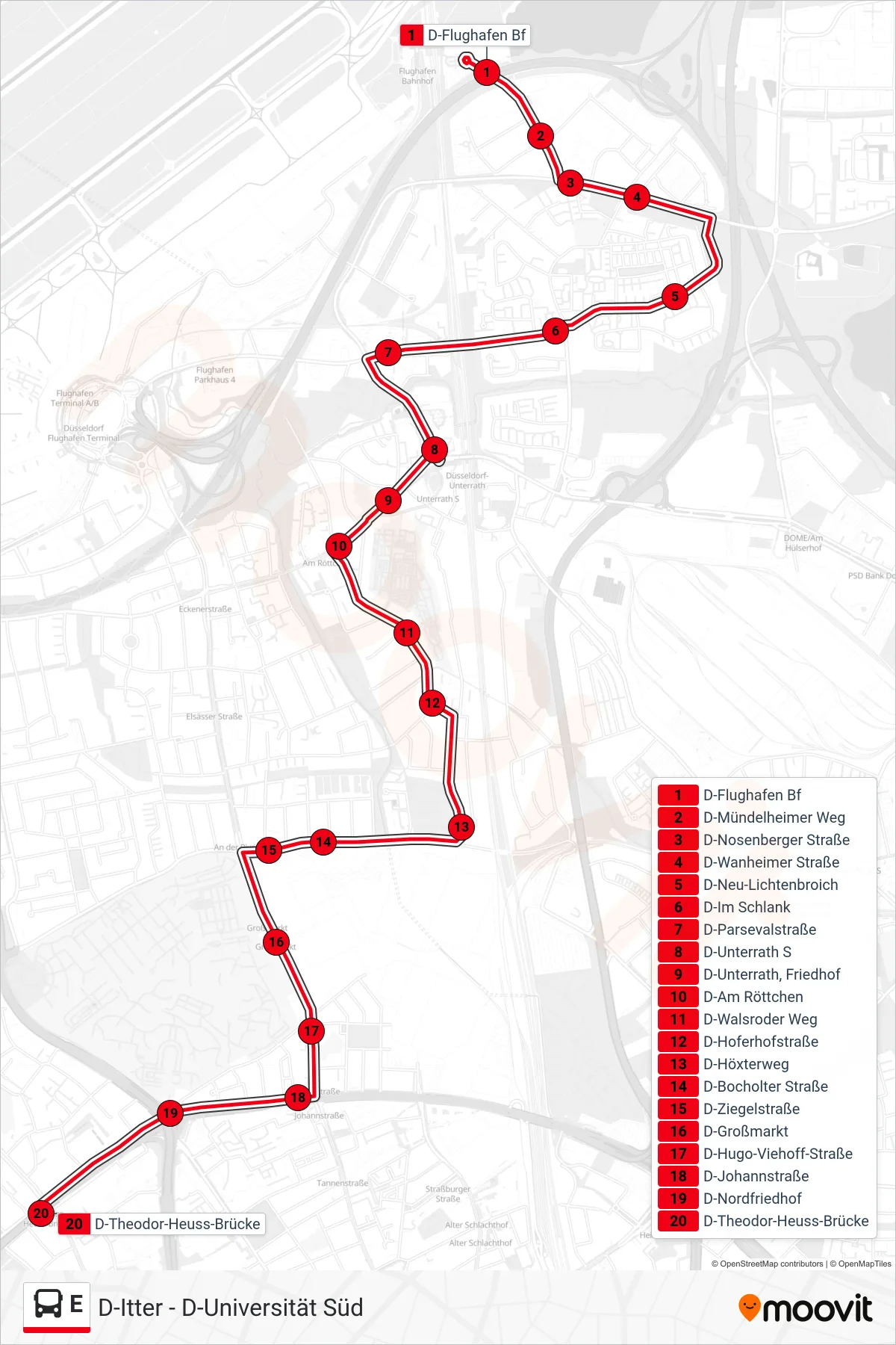
Stops list (E - D-Theodor-Heuss-Brücke)
- D-Flughafen Bf
- D-Mündelheimer Weg
- D-Nosenberger Straße
- D-Wanheimer Straße
- D-Neu-Lichtenbroich
- D-Im Schlank
- D-Parsevalstraße
- D-Unterrath S
- D-Unterrath, Friedhof
- D-Am Röttchen
- D-Walsroder Weg
- D-Hoferhofstraße
- D-Höxterweg
- D-Bocholter Straße
- D-Ziegelstraße
- D-Großmarkt
- D-Hugo-Viehoff-Straße
- D-Johannstraße
- D-Nordfriedhof
- D-Theodor-Heuss-Brücke
Change direction
- Route Map - E - D-Richardstraße
- Route Map - E - Erkrath am Brockerberg
- Route Map - E - D-Staufenplatz
- Route Map - E - D-G'Heim, Krankenhaus
- Route Map - E - D-Schlesische Straße
- Route Map - E - D-Nordfriedhof
- Route Map - E - D-Oberbilker Markt U
- Route Map - E - D-Dreherstraße
- Route Map - E - D-Am Püttkamp
- Route Map - E - Erkrath Rohrsmühle
- Route Map - E - D-Universität Süd
- Route Map - E - Düsseldorf Hbf
- Route Map - E - D-Flughafen Bf