
E Bus Route Map
View the E route map and see all E stops along the route. The map of E shows where the bus travels and the location of each stop, making it easy to understand the entire route at a glance.
Explore Rheinbahn routes on the map and see where Rheinbahn bus services operate. Use the E map to find bus stops and see how the E connects different areas along its trip.
All E stops on the map are displayed in route order, helping you follow the E bus from the first stop to the last.
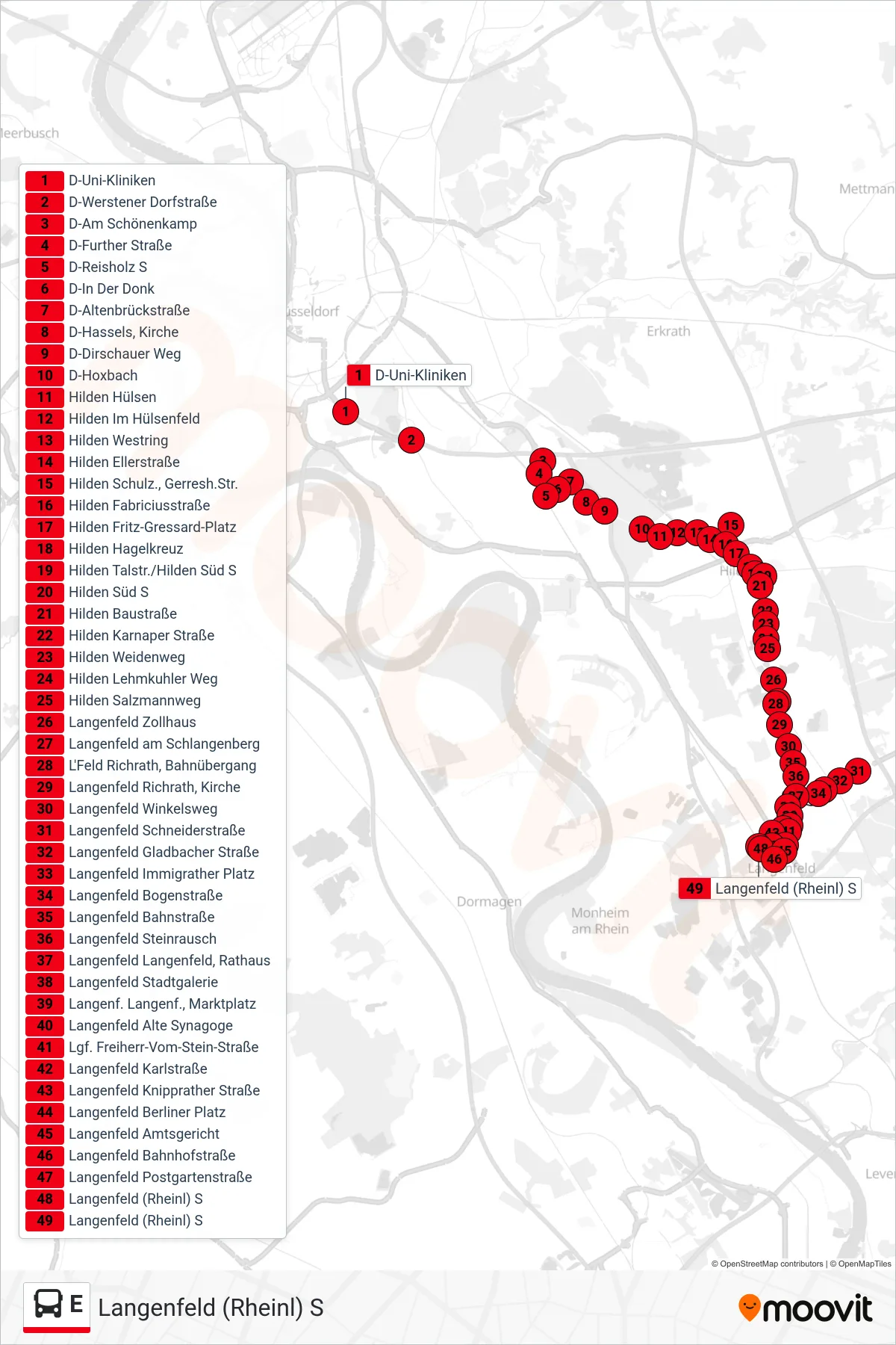
Stops list (E - Langenfeld (Rheinl) S)
- D-Uni-Kliniken
- D-Werstener Dorfstraße
- D-Am Schönenkamp
- D-Further Straße
- D-Reisholz S
- D-In Der Donk
- D-Altenbrückstraße
- D-Hassels, Kirche
- D-Dirschauer Weg
- D-Hoxbach
- Hilden Hülsen
- Hilden Im Hülsenfeld
- Hilden Westring
- Hilden Ellerstraße
- Hilden Schulz., Gerresh.Str.
- Hilden Fabriciusstraße
- Hilden Fritz-Gressard-Platz
- Hilden Hagelkreuz
- Hilden Talstr./Hilden Süd S
- Hilden Süd S
- Hilden Baustraße
- Hilden Karnaper Straße
- Hilden Weidenweg
- Hilden Lehmkuhler Weg
- Hilden Salzmannweg
- Langenfeld Zollhaus
- Langenfeld am Schlangenberg
- L'Feld Richrath, Bahnübergang
- Langenfeld Richrath, Kirche
- Langenfeld Winkelsweg
- Langenfeld Schneiderstraße
- Langenfeld Gladbacher Straße
- Langenfeld Immigrather Platz
- Langenfeld Bogenstraße
- Langenfeld Bahnstraße
- Langenfeld Steinrausch
- Langenfeld Langenfeld, Rathaus
- Langenfeld Stadtgalerie
- Langenf. Langenf., Marktplatz
- Langenfeld Alte Synagoge
- Lgf. Freiherr-Vom-Stein-Straße
- Langenfeld Karlstraße
- Langenfeld Knipprather Straße
- Langenfeld Berliner Platz
- Langenfeld Amtsgericht
- Langenfeld Bahnhofstraße
- Langenfeld Postgartenstraße
- Langenfeld (Rheinl) S
- Langenfeld (Rheinl) S
Change direction
- Route Map - E - Hilden Hilden S
- Route Map - E - D-Benrath S
- Route Map - E - Monheim (Rhein), am Kielsgraben
- Route Map - E - Langenfeld am Schlangenberg
- Route Map - E - D-Holthausen, am Falder
- Route Map - E - Hilden Schulz., Gerresh.Str.
- Route Map - E - Hilden Süd S
- Route Map - E - Hilden Fritz-Gressard-Platz
- Route Map - E - Hilden Nové-Mêsto-Platz
- Route Map - E - Monheim, Monheim Mitte
- Route Map - E - D-Reisholz S
- Route Map - E - Hilden Krankenhaus
- Route Map - E - D-Vennhauser Allee
- Route Map - E - Hilden Gabelung
- Route Map - E - Erkrath Haus Brück
- Route Map - E - Monheim (Rhein), Hegelstraße
- Route Map - E - Erkrath Hochdahl S
- Route Map - E - Monheim (Rhein), Kulturzentrum
- Route Map - E - Hilden Fritz-Gressard-Platz
- Route Map - E - D-Holthausen, am Falder
- Route Map - E - Hilden Hilden S
- Route Map - E - Erkrath Max-Planck-Straße
- Route Map - E - Monheim (Rhein), Schlegelstraße
- Route Map - E - Erkrath Neuenhausplatz
- Route Map - E - D-Torfbruchstraße
- Route Map - E - D-Vennhauser Allee
- Route Map - E - D-Sodenstraße
- Route Map - E - Monheim (Rhein), Hegelstraße
- Route Map - E - Erkrath Neuenhausplatz
- Route Map - E - D-G'Heim, Krankenhaus
- Route Map - E - Langenfeld Metzmacherstraße
- Route Map - E - D-Benrath S
- Route Map - E - D-In Der Donk
- Route Map - E - D-Heinrich-Heine-Allee U
- Route Map - E - D-Holthausen
- Route Map - E - Erkrath Hochdahler Markt
- Route Map - E - Monheim, Monheim Mitte
- Route Map - E - Hilden Trotzhilden