
E Bus Route Map
View the E route map and see all E stops along the route. The map of E shows where the bus travels and the location of each stop, making it easy to understand the entire route at a glance.
Explore Stadtwerke Remscheid routes on the map and see where Stadtwerke Remscheid bus services operate. Use the E map to find bus stops and see how the E connects different areas along its trip.
All E stops on the map are displayed in route order, helping you follow the E bus from the first stop to the last.
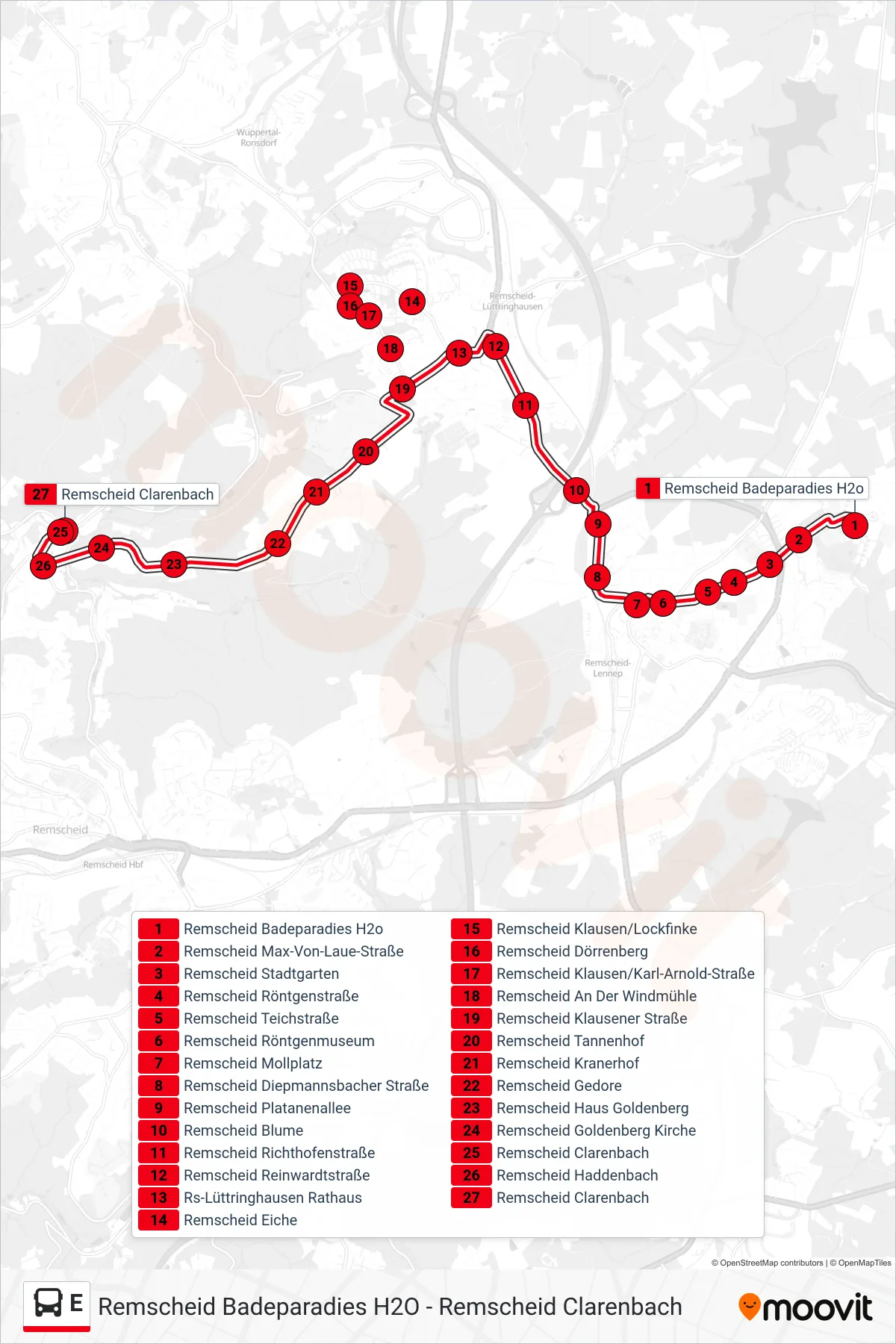
Stops list (E - Remscheid Clarenbach)
- Remscheid Badeparadies H2o
- Remscheid Max-Von-Laue-Straße
- Remscheid Stadtgarten
- Remscheid Röntgenstraße
- Remscheid Teichstraße
- Remscheid Röntgenmuseum
- Remscheid Mollplatz
- Remscheid Diepmannsbacher Straße
- Remscheid Platanenallee
- Remscheid Blume
- Remscheid Richthofenstraße
- Remscheid Reinwardtstraße
- Rs-Lüttringhausen Rathaus
- Remscheid Eiche
- Remscheid Klausen/Lockfinke
- Remscheid Dörrenberg
- Remscheid Klausen/Karl-Arnold-Straße
- Remscheid An Der Windmühle
- Remscheid Klausener Straße
- Remscheid Tannenhof
- Remscheid Kranerhof
- Remscheid Gedore
- Remscheid Haus Goldenberg
- Remscheid Goldenberg Kirche
- Remscheid Clarenbach
- Remscheid Haddenbach
- Remscheid Clarenbach