
E Bus Route Map
View the E route map and see all E stops along the route. The map of E shows where the bus travels and the location of each stop, making it easy to understand the entire route at a glance.
Explore Stadtwerke Remscheid routes on the map and see where Stadtwerke Remscheid bus services operate. Use the E map to find bus stops and see how the E connects different areas along its trip.
All E stops on the map are displayed in route order, helping you follow the E bus from the first stop to the last.
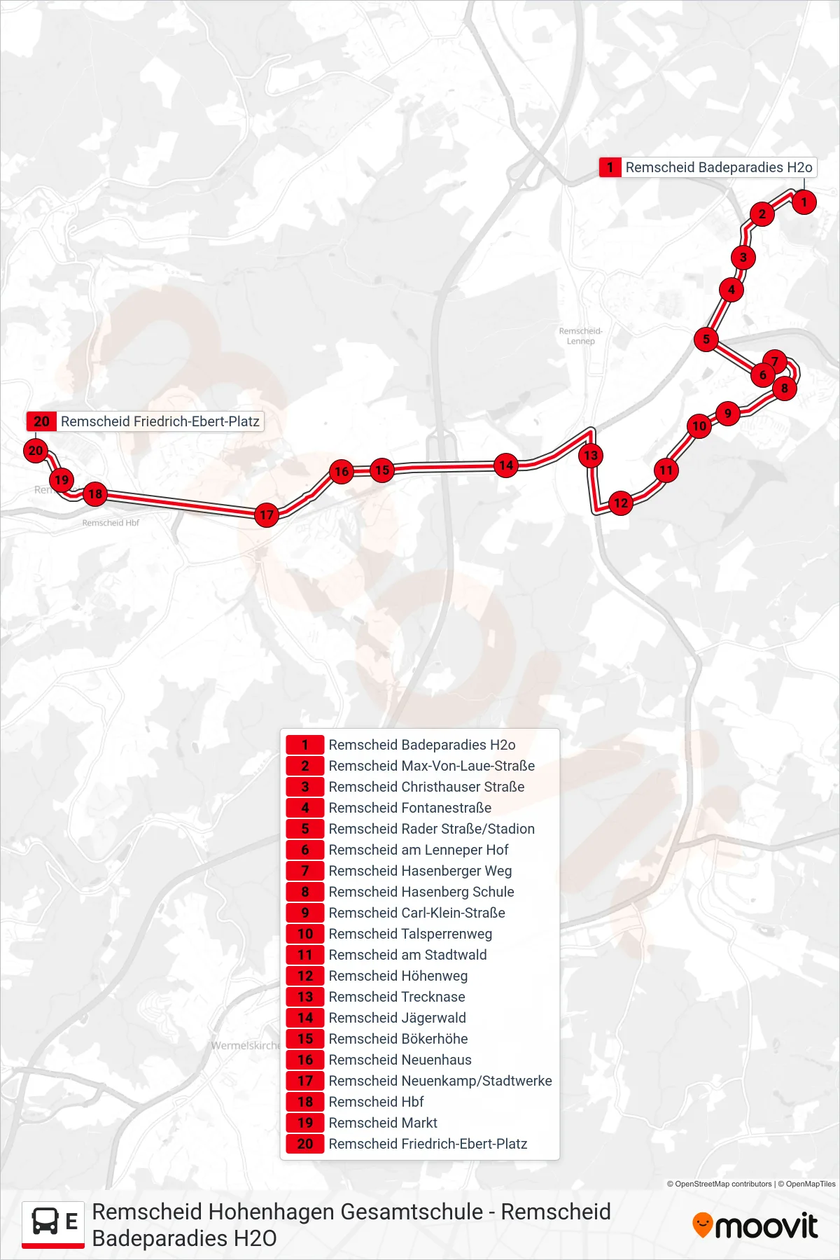
Stops list (E - Remscheid Friedrich-Ebert-Platz)
- Remscheid Badeparadies H2o
- Remscheid Max-Von-Laue-Straße
- Remscheid Christhauser Straße
- Remscheid Fontanestraße
- Remscheid Rader Straße/Stadion
- Remscheid am Lenneper Hof
- Remscheid Hasenberger Weg
- Remscheid Hasenberg Schule
- Remscheid Carl-Klein-Straße
- Remscheid Talsperrenweg
- Remscheid am Stadtwald
- Remscheid Höhenweg
- Remscheid Trecknase
- Remscheid Jägerwald
- Remscheid Bökerhöhe
- Remscheid Neuenhaus
- Remscheid Neuenkamp/Stadtwerke
- Remscheid Hbf
- Remscheid Markt
- Remscheid Friedrich-Ebert-Platz