
E Bus Route Map
View the E route map and see all E stops along the route. The map of E shows where the bus travels and the location of each stop, making it easy to understand the entire route at a glance.
Explore Rhein-Neckar-Verkehr GmbH (rnv) routes on the map and see where Rhein-Neckar-Verkehr GmbH (rnv) bus services operate. Use the E map to find bus stops and see how the E connects different areas along its trip.
All E stops on the map are displayed in route order, helping you follow the E bus from the first stop to the last.
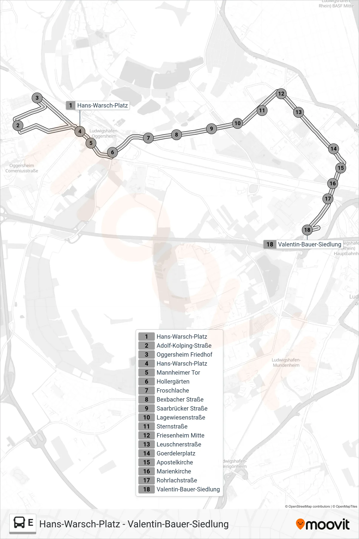
Stops list (E - Schulbus)
- Hans-Warsch-Platz
- Adolf-Kolping-Straße
- Oggersheim Friedhof
- Hans-Warsch-Platz
- - - - - -
- Hollergärten
- Froschlache
- Bexbacher Straße
- Saarbrücker Straße
- Lagewiesenstraße
- Sternstraße
- Friesenheim Mitte
- Leuschnerstraße
- Goerdelerplatz
- Apostelkirche
- Marienkirche
- Rohrlachstraße
- Valentin-Bauer-Siedlung