
E Train Route Map
View the E route map and see all E stops along the route. The map of E shows where the train travels and the location of each stop, making it easy to understand the entire route at a glance.
Explore Karlsruher Verkehrsverbund routes on the map and see where Karlsruher Verkehrsverbund train services operate. Use the E map to find train stations and see how the E connects different areas along its trip.
All E stops on the map are displayed in route order, helping you follow the E train from the first station to the last.
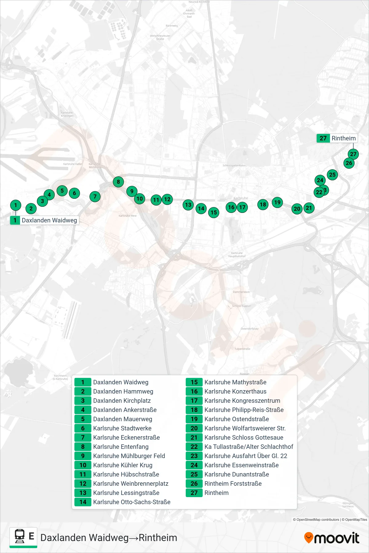

Stops list (E - Rintheim)
- Daxlanden Waidweg
- Daxlanden Hammweg
- Daxlanden Kirchplatz
- Daxlanden Ankerstraße
- Daxlanden Mauerweg
- Karlsruhe Stadtwerke
- Karlsruhe Eckenerstraße
- Karlsruhe Entenfang
- Karlsruhe Mühlburger Feld
- Karlsruhe Kühler Krug
- Karlsruhe Hübschstraße
- Karlsruhe Weinbrennerplatz
- Karlsruhe Lessingstraße
- Karlsruhe Otto-Sachs-Straße
- Karlsruhe Mathystraße
- Karlsruhe Konzerthaus
- Karlsruhe Kongresszentrum
- Karlsruhe Philipp-Reis-Straße
- Karlsruhe Ostendstraße
- Karlsruhe Wolfartsweierer Str.
- Karlsruhe Schloss Gottesaue
- Ka Tullastraße/Alter Schlachthof
- Karlsruhe Ausfahrt Über Gl. 22
- Karlsruhe Essenweinstraße
- Karlsruhe Dunantstraße
- Rintheim Forststraße
- Rintheim
Change direction
- Route Map - E - Ka Hirtenweg/Technologiepark
- Route Map - E - Blankenloch Nord
- Route Map - E - Durlach Turmberg
- Route Map - E - Waldstadt Europäische Schule
- Route Map - E - Neureut Kirchfeld
- Route Map - E - Ettlingen Stadt
- Route Map - E - Mörsch Bach-West
- Route Map - E - Karlsruhe Einfahrt Über Gl. 21
- Route Map - E - Ka Tullastraße/Alter Schlachthof
- Route Map - E - Knielingen Nord
- Route Map - E - Karlsruhe Rheinhafen
- Route Map - E - Wolfartsweier Nord
- Route Map - E - Hagsfeld Reitschulschlag
- Route Map - E - Karlsruhe Einfahrt Über Gl. 21
- Route Map - E - Ka Marktplatz (Pyramide U)
- Route Map - E - Durlach Bahnhof
- Route Map - E - Daxlanden Dornröschenweg
- Route Map - E - Karlsruhe Albtalbahnhof
- Route Map - E - Oberreut Badeniaplatz
- Route Map - E - Neureut-Heide
- Route Map - E - Karlsruhe Rheinhafen
- Route Map - E - Spöck Richard-Hecht-Schule
- Route Map - E - Durlach Turmberg
- Route Map - E - Ka Europahalle/Europabad
- Route Map - E - Ka Tullastraße/Alter Schlachthof
- Route Map - E - Karlsruhe Schillerstraße
- Route Map - E - Daxlanden Waidweg