
E Bus Route Map
View the E route map and see all E stops along the route. The map of E shows where the bus travels and the location of each stop, making it easy to understand the entire route at a glance.
Explore Stadtwerke Biberach routes on the map and see where Stadtwerke Biberach bus services operate. Use the E map to find bus stops and see how the E connects different areas along its trip.
All E stops on the map are displayed in route order, helping you follow the E bus from the first stop to the last.
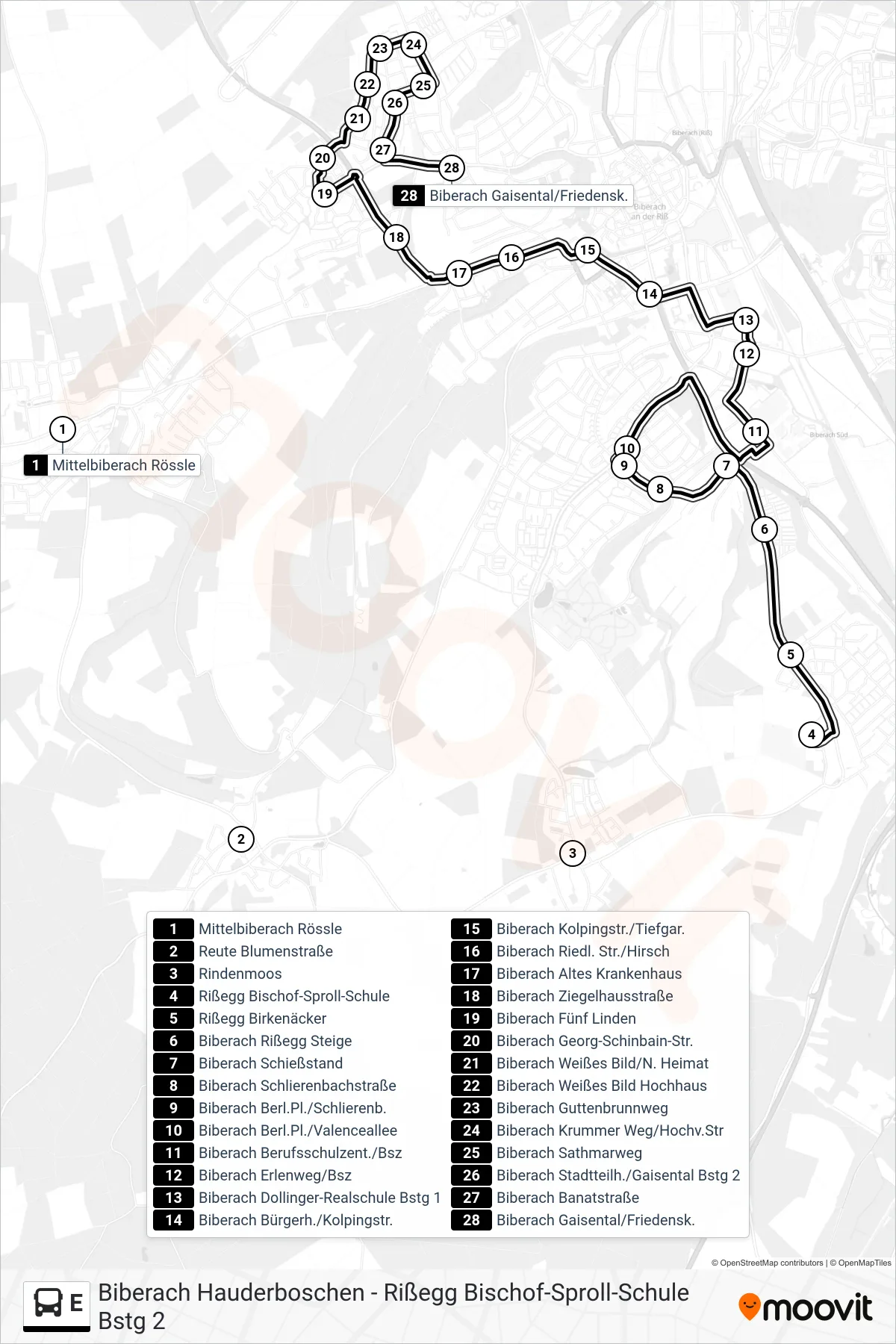
Stops list (E - Biberach Gaisental/Friedensk.)
- Mittelbiberach Rössle
- Reute Blumenstraße
- Rindenmoos
- Rißegg Bischof-Sproll-Schule
- Rißegg Birkenäcker
- Biberach Rißegg Steige
- Biberach Schießstand
- Biberach Schlierenbachstraße
- Biberach Berl.Pl./Schlierenb.
- Biberach Berl.Pl./Valenceallee
- Biberach Berufsschulzent./Bsz
- Biberach Erlenweg/Bsz
- Biberach Dollinger-Realschule Bstg 1
- Biberach Bürgerh./Kolpingstr.
- Biberach Kolpingstr./Tiefgar.
- Biberach Riedl. Str./Hirsch
- Biberach Altes Krankenhaus
- Biberach Ziegelhausstraße
- Biberach Fünf Linden
- Biberach Georg-Schinbain-Str.
- Biberach Weißes Bild/N. Heimat
- Biberach Weißes Bild Hochhaus
- Biberach Guttenbrunnweg
- Biberach Krummer Weg/Hochv.Str
- Biberach Sathmarweg
- Biberach Stadtteilh./Gaisental Bstg 2
- Biberach Banatstraße
- Biberach Gaisental/Friedensk.