
E Bus Route Map
View the E route map and see all E stops along the route. The map of E shows where the bus travels and the location of each stop, making it easy to understand the entire route at a glance.
Explore Stadtverkehr Tüb. routes on the map and see where Stadtverkehr Tüb. bus services operate. Use the E map to find bus stops and see how the E connects different areas along its trip.
All E stops on the map are displayed in route order, helping you follow the E bus from the first stop to the last.
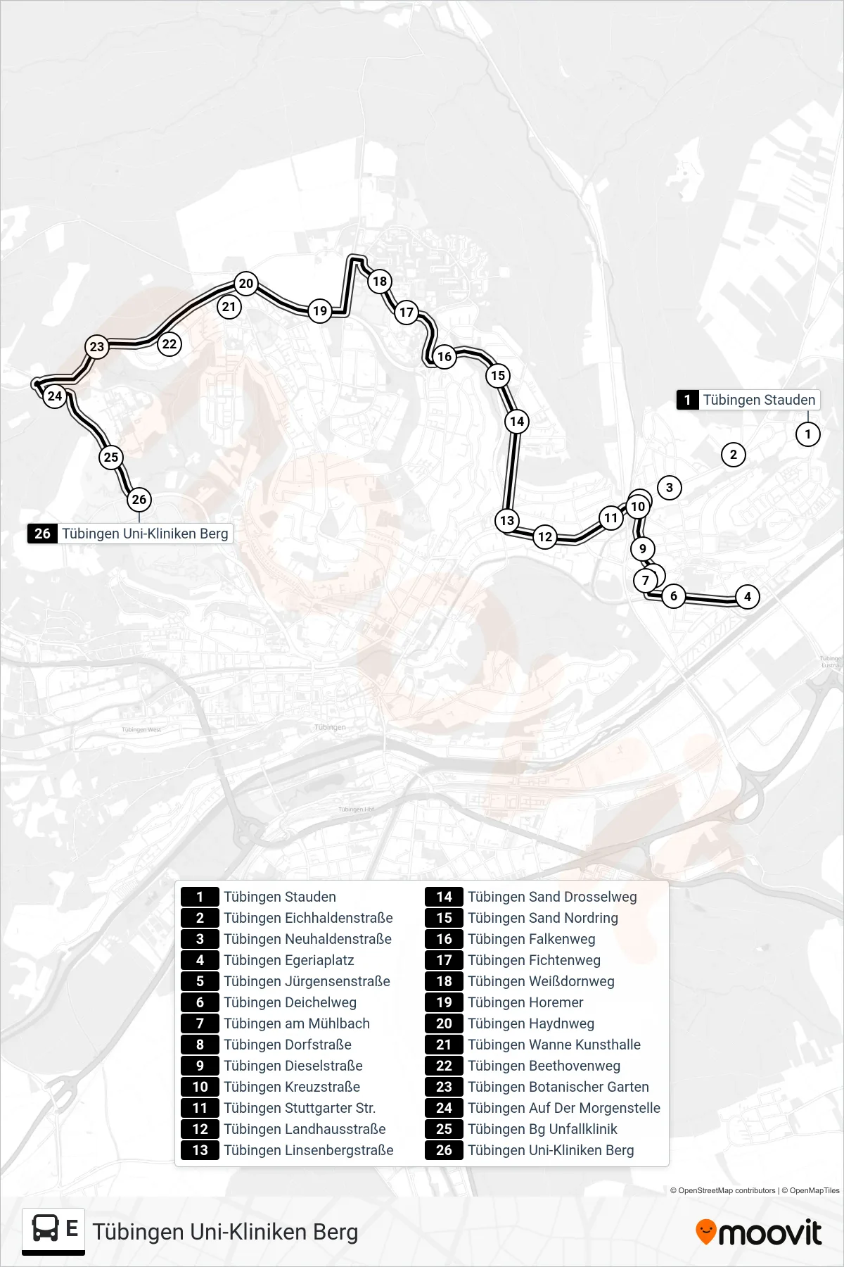
Stops list (E - Tübingen Uni-Kliniken Berg)
- Tübingen Stauden
- Tübingen Eichhaldenstraße
- Tübingen Neuhaldenstraße
- Tübingen Egeriaplatz
- Tübingen Jürgensenstraße
- Tübingen Deichelweg
- Tübingen am Mühlbach
- Tübingen Dorfstraße
- Tübingen Dieselstraße
- Tübingen Kreuzstraße
- Tübingen Stuttgarter Str.
- Tübingen Landhausstraße
- Tübingen Linsenbergstraße
- Tübingen Sand Drosselweg
- Tübingen Sand Nordring
- Tübingen Falkenweg
- Tübingen Fichtenweg
- Tübingen Weißdornweg
- Tübingen Horemer
- Tübingen Haydnweg
- Tübingen Wanne Kunsthalle
- Tübingen Beethovenweg
- Tübingen Botanischer Garten
- Tübingen Auf Der Morgenstelle
- Tübingen Bg Unfallklinik
- Tübingen Uni-Kliniken Berg