
E10 Bus Route Map
View the E10 route map and see all E10 stops along the route. The map of E10 shows where the bus travels and the location of each stop, making it easy to understand the entire route at a glance.
Explore Lucca and Province - Tuscan Bus Lines routes on the map and see where Lucca and Province - Tuscan Bus Lines bus services operate. Use the E10 map to find bus stops and see how the E10 connects different areas along its trip.
All E10 stops on the map are displayed in route order, helping you follow the E10 bus from the first stop to the last.
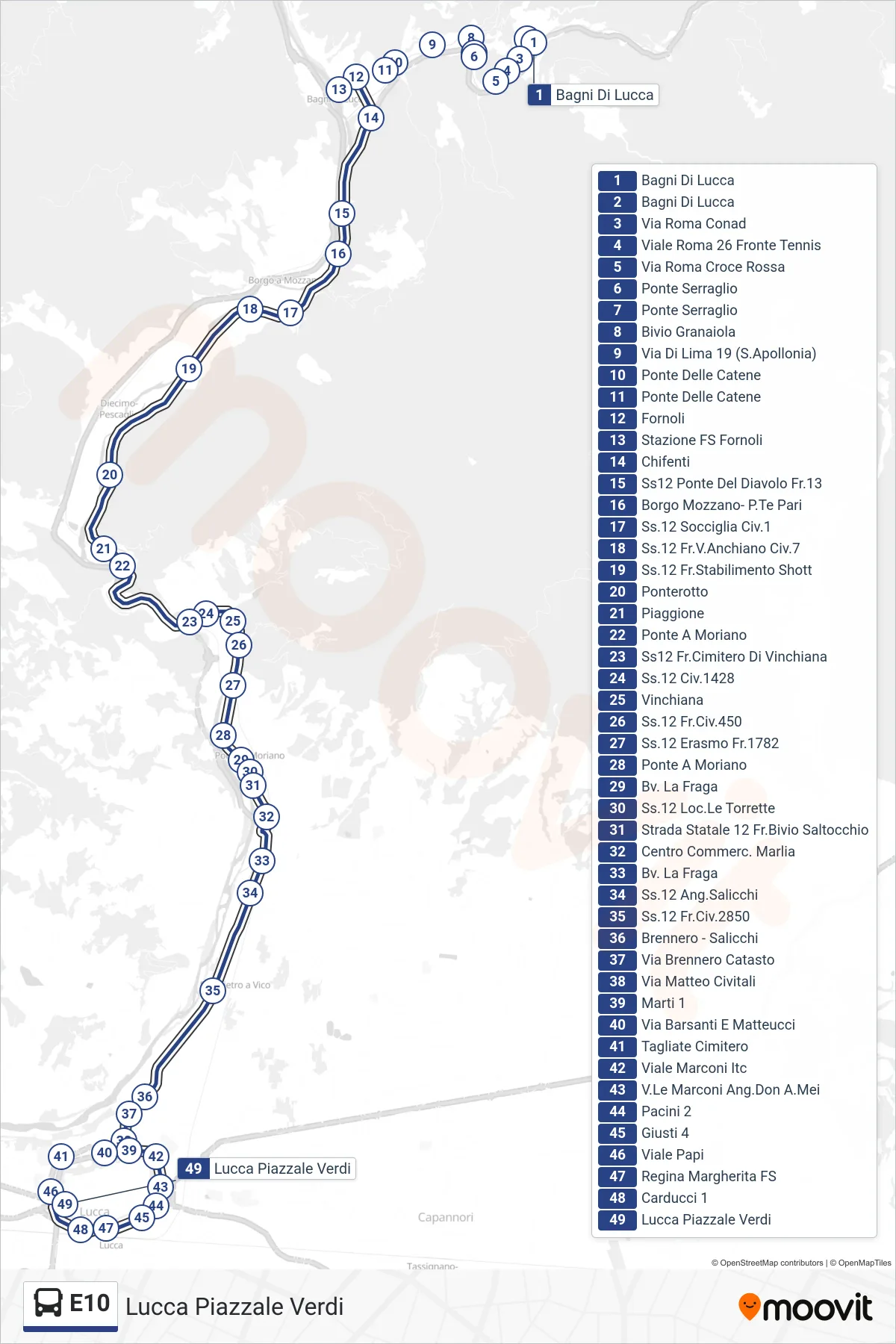
Stops list (E10 - Lucca Piazzale Verdi)
- Bagni Di Lucca
- Bagni Di Lucca
- Rome Street Conad
- Viale Roma 26 Opposite Tennis
- Via Roma Red Cross
- Ponte Serraglio
- Ponte Serraglio
- Granaiola Junction
- Via Di Lima 19 (St. Apollonia)
- Chains Bridge
- Chains Bridge
- Fornoli
- Fornoli Railway Station
- Chifenti
- State Road 12 Devil's Bridge No.13
- Borgo Mozzano - Pari Bridge
- SS12 Socciglia No. 1
- State Road 12 across from Anchiano #7
- State Road 12 Shott Factory
- Ponterotto
- Piaggione
- Ponte A Moriano
- State Road 12 Vinchiana Cemetery
- State Road 12 No.1428
- Vinchiana
- State Road 12 No. 450
- SS12 Erasmo 1782
- Ponte A Moriano
- La Fraga Junction
- State Road 12 Torrette Area
- State Road 12 Junction Saltocchio
- Marlia Shopping Center
- La Fraga Junction
- SS12 Salicchi Corner
- State Road 12 #2850
- Brennero - Salicchi
- Via Brennero Land Registry
- Matteo Civitali Street
- Marti 1
- Via Barsanti And Matteucci
- Tagliate Cemetery
- Viale Marconi ITC
- Marconi Avenue Don Mei Corner
- Pacini 2
- Giusti 4
- Viale Papi
- Regina Margherita Railway Station
- Carducci 1
- Lucca Piazzale Verdi