
E111 Bus Route Map
View the E111 route map and see all E111 stops along the route. The map of E111 shows where the bus travels and the location of each stop, making it easy to understand the entire route at a glance.
Explore Busitalia - Sita Nord s.r.l. routes on the map and see where Busitalia - Sita Nord s.r.l. bus services operate. Use the E111 map to find bus stops and see how the E111 connects different areas along its trip.
All E111 stops on the map are displayed in route order, helping you follow the E111 bus from the first stop to the last.
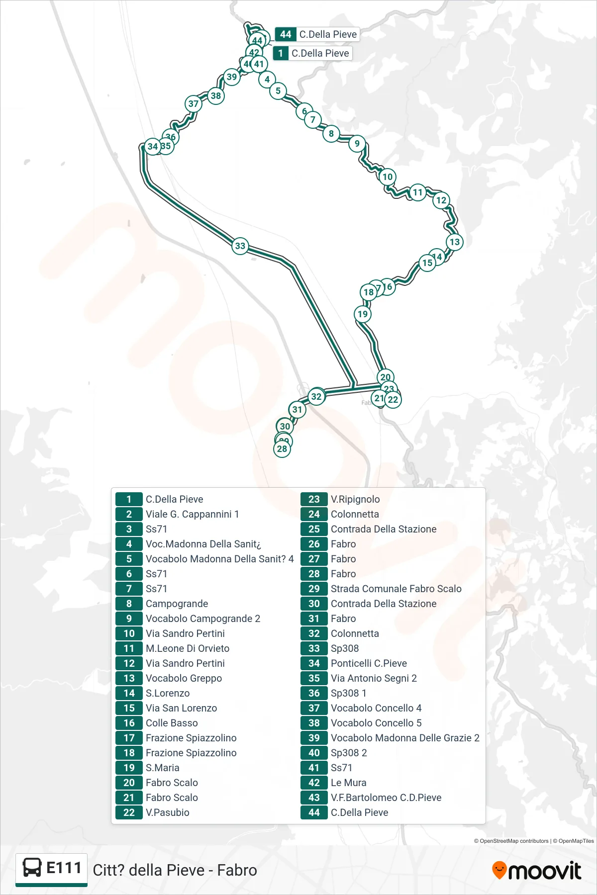
Stops list (E111 - Città della Pieve→Città della Pieve)
- Città della Pieve
- Viale G. Cappannini 1
- State Road 71
- Madonna Della Sanita Area
- Madonna Della Sanita Area 4
- State Road 71
- State Road 71
- Campogrande
- Campogrande Area 2
- Sandro Pertini Street
- M.Leone Di Orvieto
- Sandro Pertini Street
- Greppo Area
- S. Lorenzo
- San Lorenzo Street
- Colle Basso
- Spiazzolino District
- Spiazzolino District
- Saint Mary
- Fabro Station
- Fabro Station
- Via Pasubio
- Via Ripignolo
- Colonnetta
- Station District
- Fabro
- Fabro
- Fabro
- Municipal Road Fabro Scalo
- Station District
- Fabro
- Colonnetta
- SP308
- Ponticelli Parish Church
- Antonio Segni Street 2
- Provincial Road 308 1
- Concello Area 4
- Concello Area 5
- Madonna Delle Grazie Hamlet 2
- Provincial Road 308 2
- State Road 71
- The Walls
- Via F. Bartolomeo Citta della Pieve
- Città della Pieve