
E20 Bus Route Map
View the E20 route map and see all E20 stops along the route. The map of E20 shows where the bus travels and the location of each stop, making it easy to understand the entire route at a glance.
Explore Soler i Sauret routes on the map and see where Soler i Sauret bus services operate. Use the E20 map to find bus stops and see how the E20 connects different areas along its trip.
All E20 stops on the map are displayed in route order, helping you follow the E20 bus from the first stop to the last.
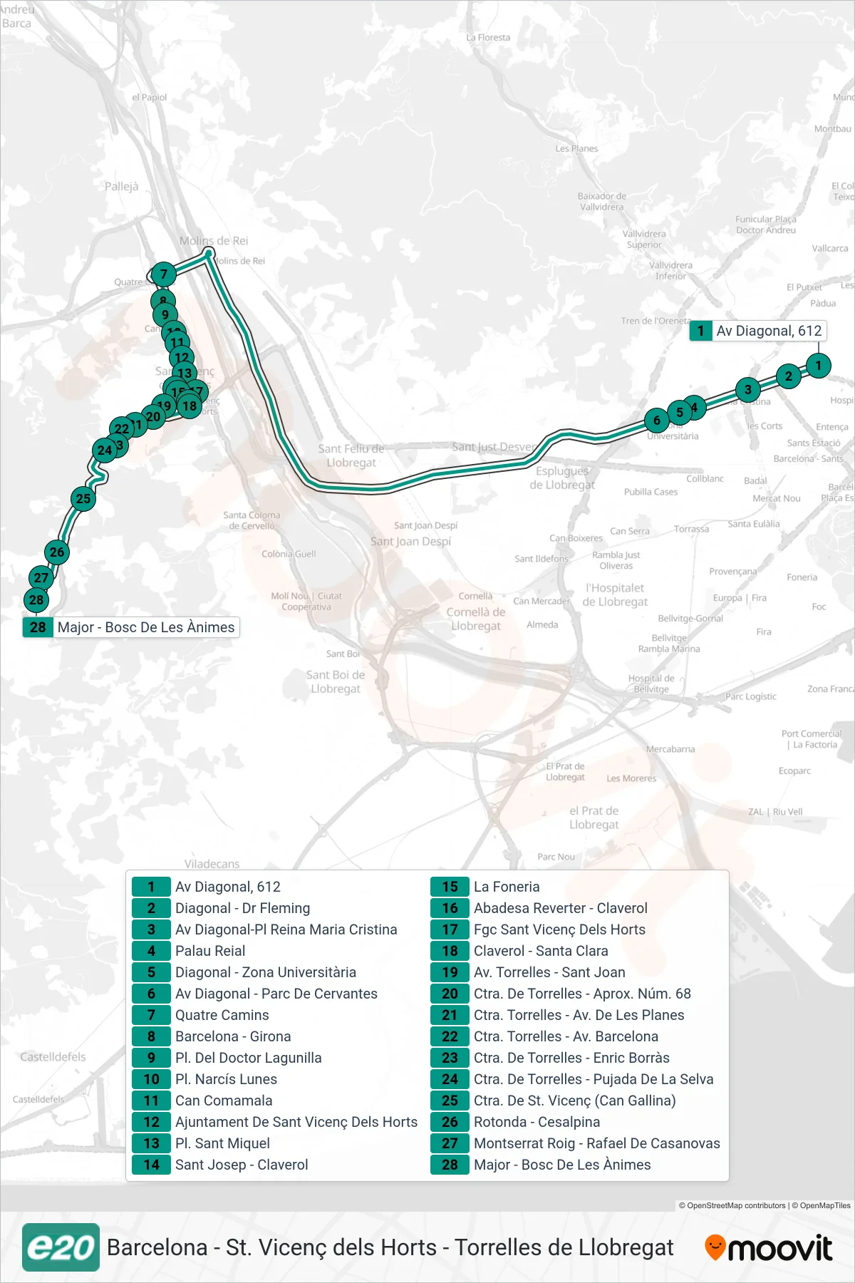
Stops list (E20 - Av Diagonal, 612→Major - Bosc De Les Ànimes)
- Av Diagonal, 612
- Diagonal - Dr Fleming
- Av Diagonal-Pl Reina Maria Cristina
- Palau Reial
- Diagonal - Zona Universitària
- Av Diagonal - Parc De Cervantes
- Quatre Camins
- Barcelona - Girona
- Pl. Del Doctor Lagunilla
- Pl. Narcís Lunes
- Can Comamala
- Ajuntament De Sant Vicenç Dels Horts
- Pl. Sant Miquel
- Sant Josep - Claverol
- La Foneria
- Abadesa Reverter - Claverol
- Fgc Sant Vicenç Dels Horts
- Claverol - Santa Clara
- Av. Torrelles - Sant Joan
- Ctra. De Torrelles - Aprox. Núm. 68
- Ctra. Torrelles - Av. De Les Planes
- Ctra. Torrelles - Av. Barcelona
- Ctra. De Torrelles - Enric Borràs
- Ctra. De Torrelles - Pujada De La Selva
- Ctra. De St. Vicenç (Can Gallina)
- Rotonda - Cesalpina
- Montserrat Roig - Rafael De Casanovas
- Major - Bosc De Les Ànimes