
E3 Bus Route Map
View the E3 route map and see all E3 stops along the route. The map of E3 shows where the bus travels and the location of each stop, making it easy to understand the entire route at a glance.
Explore SETPasto routes on the map and see where SETPasto bus services operate. Use the E3 map to find bus stops and see how the E3 connects different areas along its trip.
All E3 stops on the map are displayed in route order, helping you follow the E3 bus from the first stop to the last.
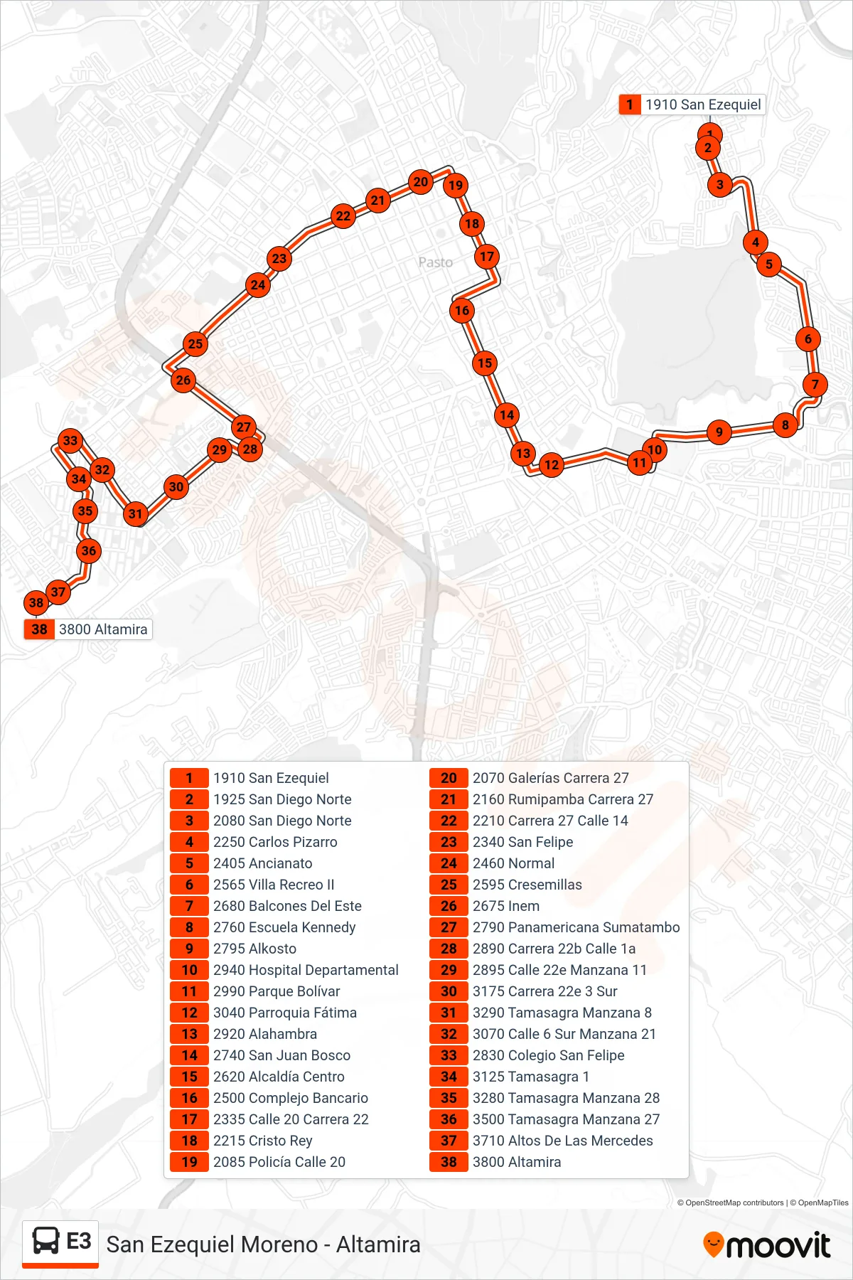
Stops list (E3 - San Ezequiel Moreno - Altamira)
- 1910 San Ezequiel
- 1925 San Diego Norte
- 2080 San Diego Norte
- 2250 Carlos Pizarro
- 2405 Ancianato
- 2565 Villa Recreo II
- 2680 Balcones Del Este
- 2760 Escuela Kennedy
- 2795 Alkosto
- 2940 Hospital Departamental
- 2990 Parque Bolívar
- 3040 Parroquia Fátima
- 2920 Alahambra
- 2740 San Juan Bosco
- 2620 Alcaldía Centro
- 2500 Complejo Bancario
- 2335 Calle 20 Carrera 22
- 2215 Cristo Rey
- 2085 Policía Calle 20
- 2070 Galerías Carrera 27
- 2160 Rumipamba Carrera 27
- 2210 Carrera 27 Calle 14
- 2340 San Felipe
- 2460 Normal
- 2595 Cresemillas
- 2675 Inem
- 2790 Panamericana Sumatambo
- 2890 Carrera 22b Calle 1a
- 2895 Calle 22e Manzana 11
- 3175 Carrera 22e 3 Sur
- 3290 Tamasagra Manzana 8
- 3070 Calle 6 Sur Manzana 21
- 2830 Colegio San Felipe
- 3125 Tamasagra 1
- 3280 Tamasagra Manzana 28
- 3500 Tamasagra Manzana 27
- 3710 Altos De Las Mercedes
- 3800 Altamira