
E30 Bus Route Map
View the E30 route map and see all E30 stops along the route. The map of E30 shows where the bus travels and the location of each stop, making it easy to understand the entire route at a glance.
Explore HST routes on the map and see where HST bus services operate. Use the E30 map to find bus stops and see how the E30 connects different areas along its trip.
All E30 stops on the map are displayed in route order, helping you follow the E30 bus from the first stop to the last.
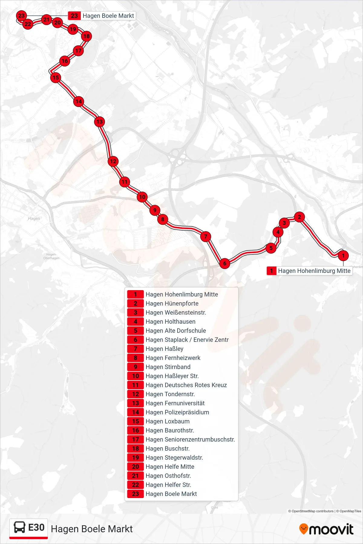
Stops list (E30 - Hagen Boele Markt)
- Hagen Hohenlimburg Mitte
- Hagen Hünenpforte
- Hagen Weißensteinstr.
- Hagen Holthausen
- Hagen Alte Dorfschule
- Hagen Staplack / Enervie Zentr
- Hagen Haßley
- Hagen Fernheizwerk
- Hagen Stirnband
- Hagen Haßleyer Str.
- Hagen Deutsches Rotes Kreuz
- Hagen Tondernstr.
- Hagen Fernuniversität
- Hagen Polizeipräsidium
- Hagen Loxbaum
- Hagen Baurothstr.
- Hagen Seniorenzentrumbuschstr.
- Hagen Buschstr.
- Hagen Stegerwaldstr.
- Hagen Helfe Mitte
- Hagen Osthofstr.
- Hagen Helfer Str.
- Hagen Boele Markt