
E430 Bus Route Map
View the E430 route map and see all E430 stops along the route. The map of E430 shows where the bus travels and the location of each stop, making it easy to understand the entire route at a glance.
Explore Busitalia - Sita Nord s.r.l. routes on the map and see where Busitalia - Sita Nord s.r.l. bus services operate. Use the E430 map to find bus stops and see how the E430 connects different areas along its trip.
All E430 stops on the map are displayed in route order, helping you follow the E430 bus from the first stop to the last.
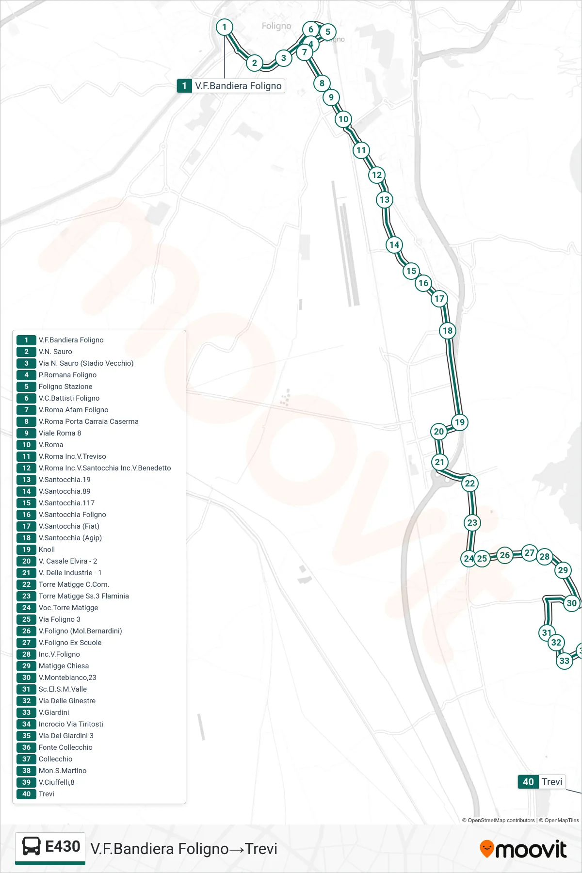
Stops list (E430 - Via Bandiera Foligno→Trevi)
- Via Bandiera Foligno
- N. Sauro Street
- Via N. Sauro (Old Stadium)
- Romana Square Foligno
- Foligno Station
- C. Battisti Street Foligno
- Via Roma Afam Foligno
- Rome Street Porta Carraia Barracks
- Roma Avenue 8
- Via Roma
- Rome Street Treviso Street Junction
- Via Roma/Via Santocchia/Via Benedetto
- Via Santocchia 19
- Santocchia Street 89
- Via Santocchia 117
- Via Santocchia Foligno
- Santocchia Street (Fiat)
- Santocchia Street (Agip)
- Knoll
- Via Casale Elvira - 2
- Industrial Street - 1
- Torre Matigge Town Hall
- Torre Matigge Flaminia State Road 3
- Torre Matigge Area
- Foligno Street 3
- Via Foligno (Bernardini Mill)
- Via Foligno Former Schools
- Foligno Street Intersection
- Matigge Church
- Monte Bianco Street 23
- Valle Elementary School
- Broom Street
- Via Giardini
- Tiritosti Junction
- Via Dei Giardini 3
- Fonte Collecchio
- Collecchio
- San Martino Mountain
- Via Ciuffelli 8
- Trevi