
E71 Bus Route Map
View the E71 route map and see all E71 stops along the route. The map of E71 shows where the bus travels and the location of each stop, making it easy to understand the entire route at a glance.
Explore BOGESTRA BUS routes on the map and see where BOGESTRA BUS bus services operate. Use the E71 map to find bus stops and see how the E71 connects different areas along its trip.
All E71 stops on the map are displayed in route order, helping you follow the E71 bus from the first stop to the last.
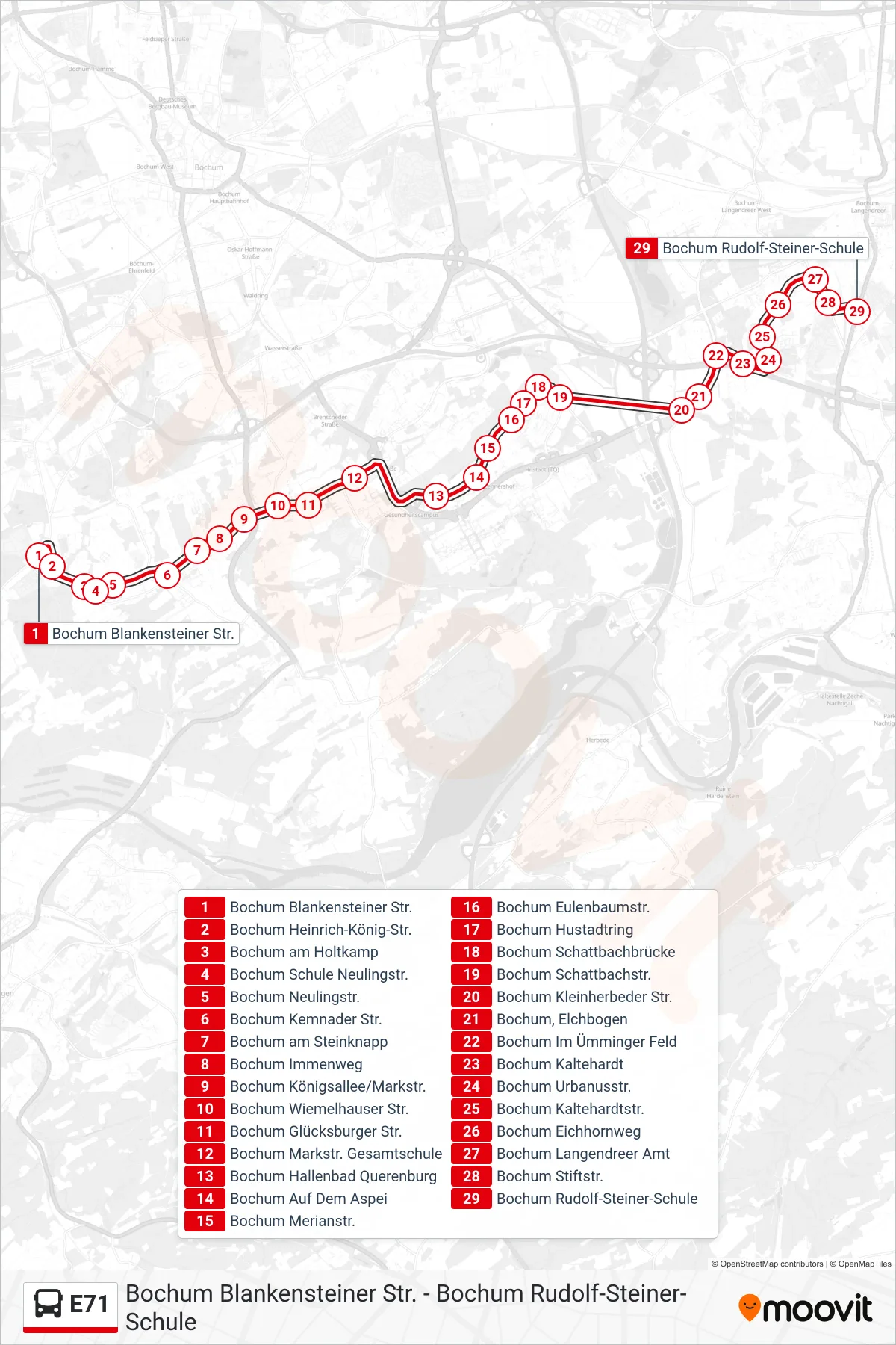
Stops list (E71 - Bochum Rudolf-Steiner-Schule)
- Bochum Blankensteiner Str.
- Bochum Heinrich-König-Str.
- Bochum am Holtkamp
- Bochum Schule Neulingstr.
- Bochum Neulingstr.
- Bochum Kemnader Str.
- Bochum am Steinknapp
- Bochum Immenweg
- Bochum Königsallee/Markstr.
- Bochum Wiemelhauser Str.
- Bochum Glücksburger Str.
- Bochum Markstr. Gesamtschule
- Bochum Hallenbad Querenburg
- Bochum Auf Dem Aspei
- Bochum Merianstr.
- Bochum Eulenbaumstr.
- Bochum Hustadtring
- Bochum Schattbachbrücke
- Bochum Schattbachstr.
- Bochum Kleinherbeder Str.
- Bochum, Elchbogen
- Bochum Im Ümminger Feld
- Bochum Kaltehardt
- Bochum Urbanusstr.
- Bochum Kaltehardtstr.
- Bochum Eichhornweg
- Bochum Langendreer Amt
- Bochum Stiftstr.
- Bochum Rudolf-Steiner-Schule