
E LINE Subway Route Map
View the E LINE route map and see all E LINE stops along the route. The map of E LINE shows where the subway travels and the location of each stop, making it easy to understand the entire route at a glance.
Explore Metro routes on the map and see where Metro subway services operate. Use the E LINE map to find subway stations and see how the E LINE connects different areas along its trip.
All E LINE stops on the map are displayed in route order, helping you follow the E LINE subway from the first station to the last.
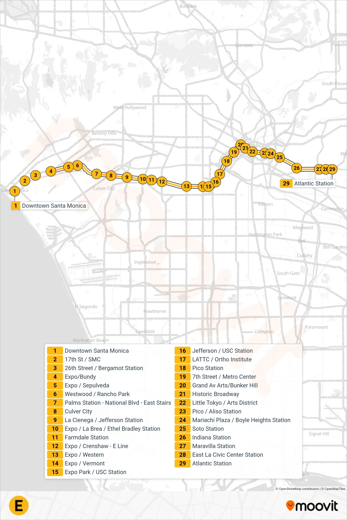
Stops list (E LINE - Eastbound to East Los Angeles)
- Downtown Santa Monica
- 17th St / SMC
- 26th Street / Bergamot Station
- Expo/Bundy
- Expo / Sepulveda
- Westwood / Rancho Park
- Palms Station - National Blvd - East Stairs
- Culver City
- La Cienega / Jefferson Station
- Expo / La Brea / Ethel Bradley Station
- Farmdale Station
- Expo / Crenshaw - E Line
- Expo / Western
- Expo / Vermont
- Expo Park / USC Station
- Jefferson / USC Station
- LATTC / Ortho Institute
- Pico Station
- 7th Street / Metro Center
- Grand Av Arts/Bunker Hill
- Historic Broadway
- Little Tokyo / Arts District
- Pico / Aliso Station
- Mariachi Plaza / Boyle Heights Station
- Soto Station
- Indiana Station
- Maravilla Station
- East La Civic Center Station
- Atlantic Station