
E RED Bus Route Map
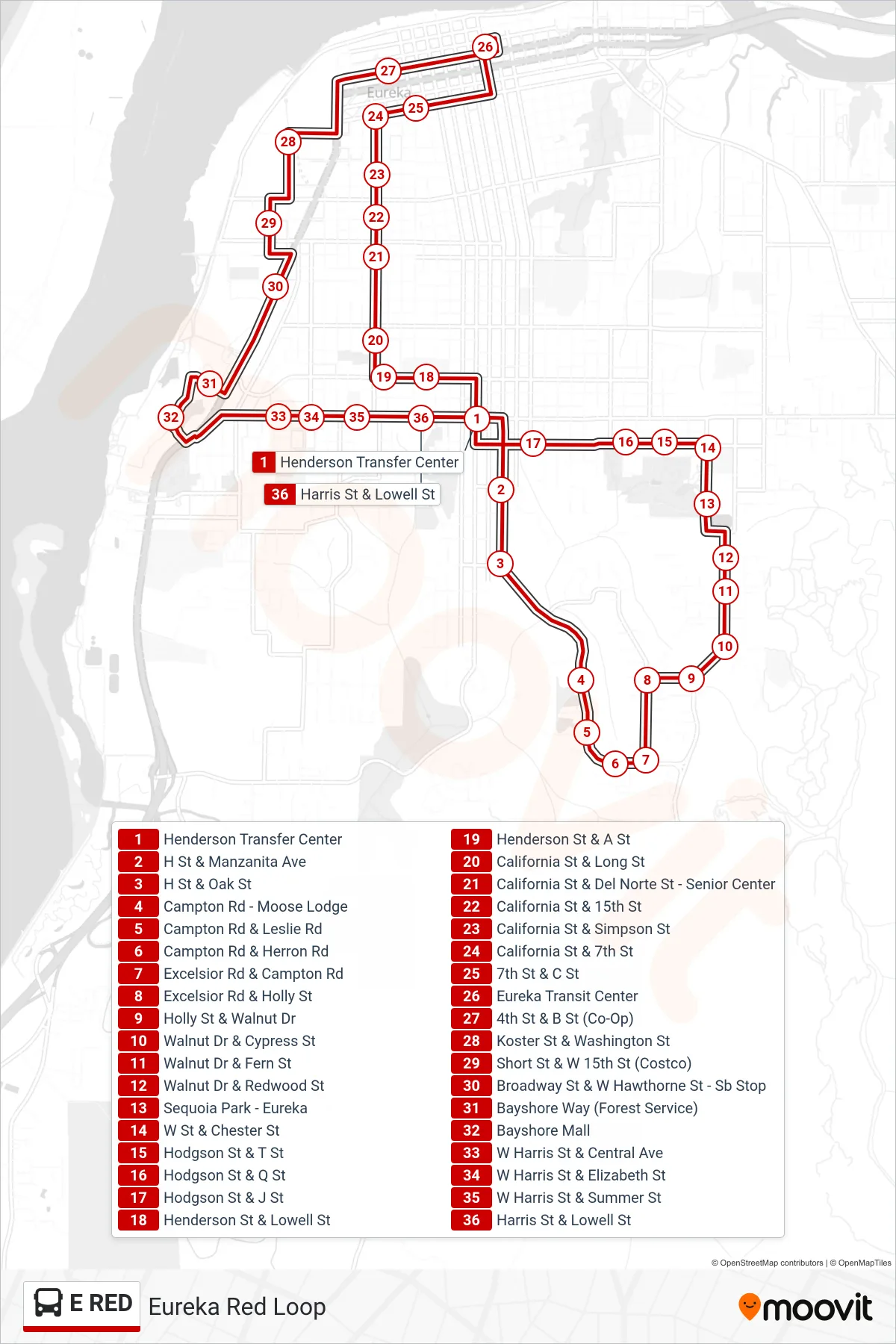
View the E RED route map and see all E RED stops along the route. The map of E RED shows where the bus travels and the location of each stop, making it easy to understand the entire route at a glance.
Explore Eureka Transit System routes on the map and see where Eureka Transit System bus services operate. Use the E RED map to find bus stops and see how the E RED connects different areas along its trip.
All E RED stops on the map are displayed in route order, helping you follow the E RED bus from the first stop to the last.
Stops list (E RED - Eureka Red Loop)
- Henderson Transfer Center
- H St & Manzanita Ave
- H St & Oak St
- Campton Rd - Moose Lodge
- Campton Rd & Leslie Rd
- Campton Rd & Herron Rd
- Excelsior Rd & Campton Rd
- Excelsior Rd & Holly St
- Holly St & Walnut Dr
- Walnut Dr & Cypress St
- Walnut Dr & Fern St
- Walnut Dr & Redwood St
- Sequoia Park - Eureka
- W St & Chester St
- Hodgson St & T St
- Hodgson St & Q St
- Hodgson St & J St
- Henderson St & Lowell St
- Henderson St & A St
- California St & Long St
- California St & Del Norte St - Senior Center
- California St & 15th St
- California St & Simpson St
- California St & 7th St
- 7th St & C St
- Eureka Transit Center
- 4th St & B St (Co-Op)
- Koster St & Washington St
- Short St & W 15th St (Costco)
- Broadway St & W Hawthorne St - Sb Stop
- Bayshore Way (Forest Service)
- Bayshore Mall
- W Harris St & Central Ave
- W Harris St & Elizabeth St
- W Harris St & Summer St
- Harris St & Lowell St