
EART Bus Route Map
View the EART route map and see all EART stops along the route. The map of EART shows where the bus travels and the location of each stop, making it easy to understand the entire route at a glance.
Explore Valley Metro-Bus routes on the map and see where Valley Metro-Bus bus services operate. Use the EART map to find bus stops and see how the EART connects different areas along its trip.
All EART stops on the map are displayed in route order, helping you follow the EART bus from the first stop to the last.
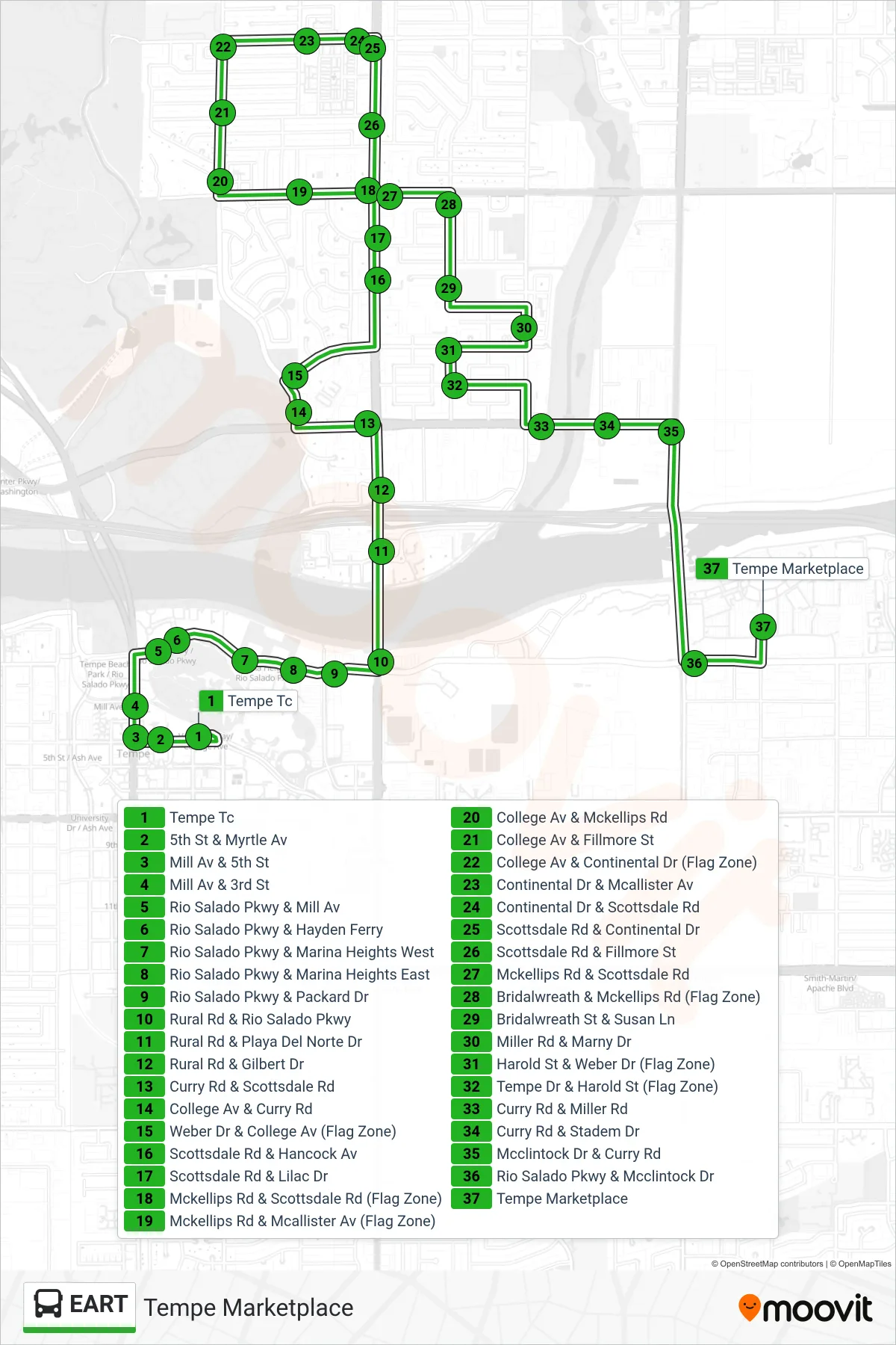
Stops list (EART - Tempe Marketplace)
- Tempe Tc
- 5th St & Myrtle Av
- Mill Av & 5th St
- Mill Av & 3rd St
- Rio Salado Pkwy & Mill Av
- Rio Salado Pkwy & Hayden Ferry
- Rio Salado Pkwy & Marina Heights West
- Rio Salado Pkwy & Marina Heights East
- Rio Salado Pkwy & Packard Dr
- Rural Rd & Rio Salado Pkwy
- Rural Rd & Playa Del Norte Dr
- Rural Rd & Gilbert Dr
- Curry Rd & Scottsdale Rd
- College Av & Curry Rd
- Weber Dr & College Av (Flag Zone)
- Scottsdale Rd & Hancock Av
- Scottsdale Rd & Lilac Dr
- Mckellips Rd & Scottsdale Rd (Flag Zone)
- Mckellips Rd & Mcallister Av (Flag Zone)
- College Av & Mckellips Rd
- College Av & Fillmore St
- College Av & Continental Dr (Flag Zone)
- Continental Dr & Mcallister Av
- Continental Dr & Scottsdale Rd
- Scottsdale Rd & Continental Dr
- Scottsdale Rd & Fillmore St
- Mckellips Rd & Scottsdale Rd
- Bridalwreath & Mckellips Rd (Flag Zone)
- Bridalwreath St & Susan Ln
- Miller Rd & Marny Dr
- Harold St & Weber Dr (Flag Zone)
- Tempe Dr & Harold St (Flag Zone)
- Curry Rd & Miller Rd
- Curry Rd & Stadem Dr
- Mcclintock Dr & Curry Rd
- Rio Salado Pkwy & Mcclintock Dr
- Tempe Marketplace