
ECRO Bus Route Map
View the ECRO route map and see all ECRO stops along the route. The map of ECRO shows where the bus travels and the location of each stop, making it easy to understand the entire route at a glance.
Explore SamTrans routes on the map and see where SamTrans bus services operate. Use the ECRO map to find bus stops and see how the ECRO connects different areas along its trip.
All ECRO stops on the map are displayed in route order, helping you follow the ECRO bus from the first stop to the last.
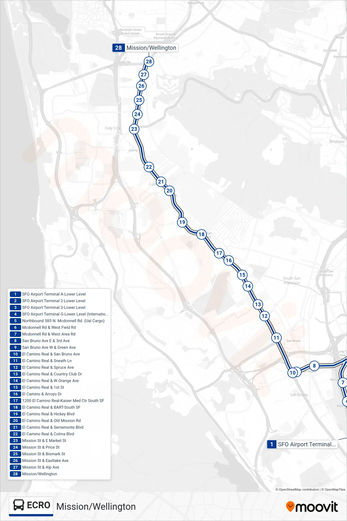
Stops list (ECRO - Mission/Wellington)
- SFO Airport Terminal A-Lower Level
- SFO Airport Terminal 2-Lower Level
- SFO Airport Terminal 3-Lower Level
- SFO Airport Terminal G-Lower Level (International Terminal Courtyard)
- Northbound 585 N. Mcdonnell Rd. (Ual Cargo)
- Mcdonnell Rd & West Field Rd
- Mcdonnell Rd & West Area Rd
- San Bruno Ave E & 3rd Ave
- San Bruno Ave W & Green Ave
- El Camino Real & San Bruno Ave
- El Camino Real & Sneath Ln
- El Camino Real & Spruce Ave
- El Camino Real & Country Club Dr
- El Camino Real & W Orange Ave
- El Camino Real & 1st St
- El Camino & Arroyo Dr
- 1200 El Camino Real-Kaiser Med Ctr South SF
- El Camino Real & BART-South SF
- El Camino Real & Hickey Blvd
- El Camino Real & Old Mission Rd
- El Camino Real & Serramonte Blvd
- El Camino Real & Colma Blvd
- Mission St & E Market St
- Mission St & Price St
- Mission St & Bismark St
- Mission St & Eastlake Ave
- Mission St & Alp Ave
- Mission/Wellington