
F Bus Route Map
View the F route map and see all F stops along the route. The map of F shows where the bus travels and the location of each stop, making it easy to understand the entire route at a glance.
Explore Astuce (Métropole Rouen Normandie) routes on the map and see where Astuce (Métropole Rouen Normandie) bus services operate. Use the F map to find bus stops and see how the F connects different areas along its trip.
All F stops on the map are displayed in route order, helping you follow the F bus from the first stop to the last.
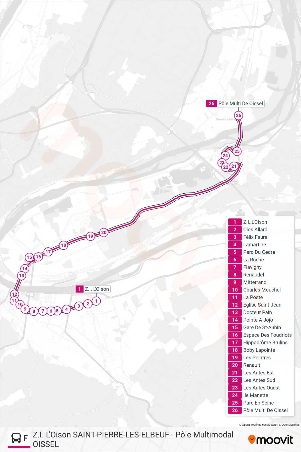
Stops list (F - Pôle Multimodal De Oissel)
- Z.I. L'Oison
- Clos Allard
- Félix Faure
- Lamartine
- Parc Du Cedre
- La Ruche
- Flavigny
- Renaudel
- Mitterrand
- Charles Mouchel
- La Poste
- Église Saint-Jean
- Docteur Pain
- Pointe A Jojo
- Gare De St-Aubin
- Espace Des Foudriots
- Hippodrôme Brulins
- Boby Lapointe
- Les Peintres
- Renault
- Les Antes Est
- Les Antes Sud
- Les Antes Ouest
- Ile Manette
- Parc En Seine
- Pôle Multi De Oissel