
F Bus Route Map
View the F route map and see all F stops along the route. The map of F shows where the bus travels and the location of each stop, making it easy to understand the entire route at a glance.
Explore Cap Cotentin (Cherbourg, Agglo. du Cotentin) routes on the map and see where Cap Cotentin (Cherbourg, Agglo. du Cotentin) bus services operate. Use the F map to find bus stops and see how the F connects different areas along its trip.
All F stops on the map are displayed in route order, helping you follow the F bus from the first stop to the last.
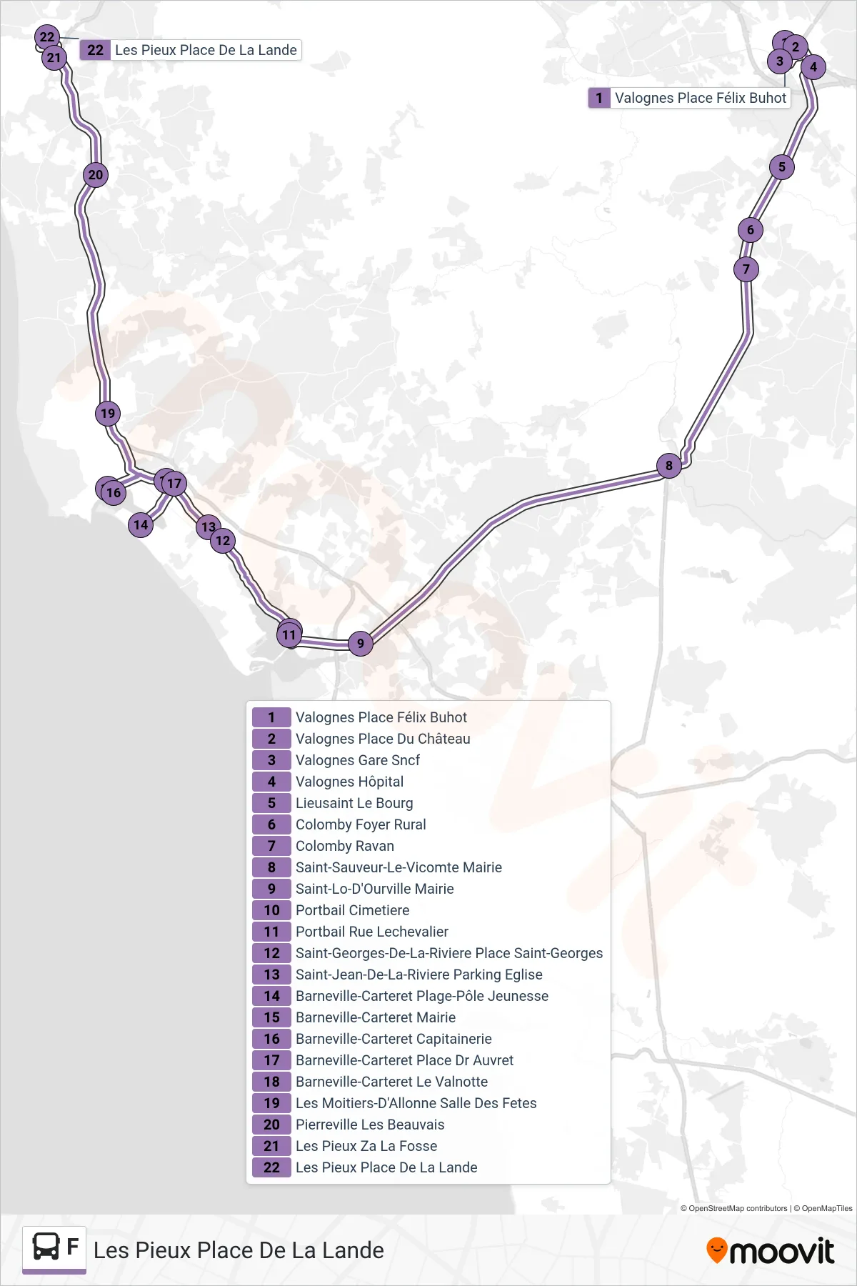
Stops list (F - Les Pieux Place De La Lande)
- Valognes Place Félix Buhot
- Valognes Place Du Château
- Valognes Gare Sncf
- Valognes Hôpital
- Lieusaint Le Bourg
- Colomby Foyer Rural
- Colomby Ravan
- Saint-Sauveur-Le-Vicomte Mairie
- Saint-Lo-D'Ourville Mairie
- Portbail Cimetiere
- Portbail Rue Lechevalier
- Saint-Georges-De-La-Riviere Place Saint-Georges
- Saint-Jean-De-La-Riviere Parking Eglise
- Barneville-Carteret Plage-Pôle Jeunesse
- Barneville-Carteret Mairie
- Barneville-Carteret Capitainerie
- Barneville-Carteret Place Dr Auvret
- Barneville-Carteret Le Valnotte
- Les Moitiers-D'Allonne Salle Des Fetes
- Pierreville Les Beauvais
- Les Pieux Za La Fosse
- Les Pieux Place De La Lande