
F1 Bus Route Map
View the F1 route map and see all F1 stops along the route. The map of F1 shows where the bus travels and the location of each stop, making it easy to understand the entire route at a glance.
Explore Autobuses routes on the map and see where Autobuses bus services operate. Use the F1 map to find bus stops and see how the F1 connects different areas along its trip.
All F1 stops on the map are displayed in route order, helping you follow the F1 bus from the first stop to the last.
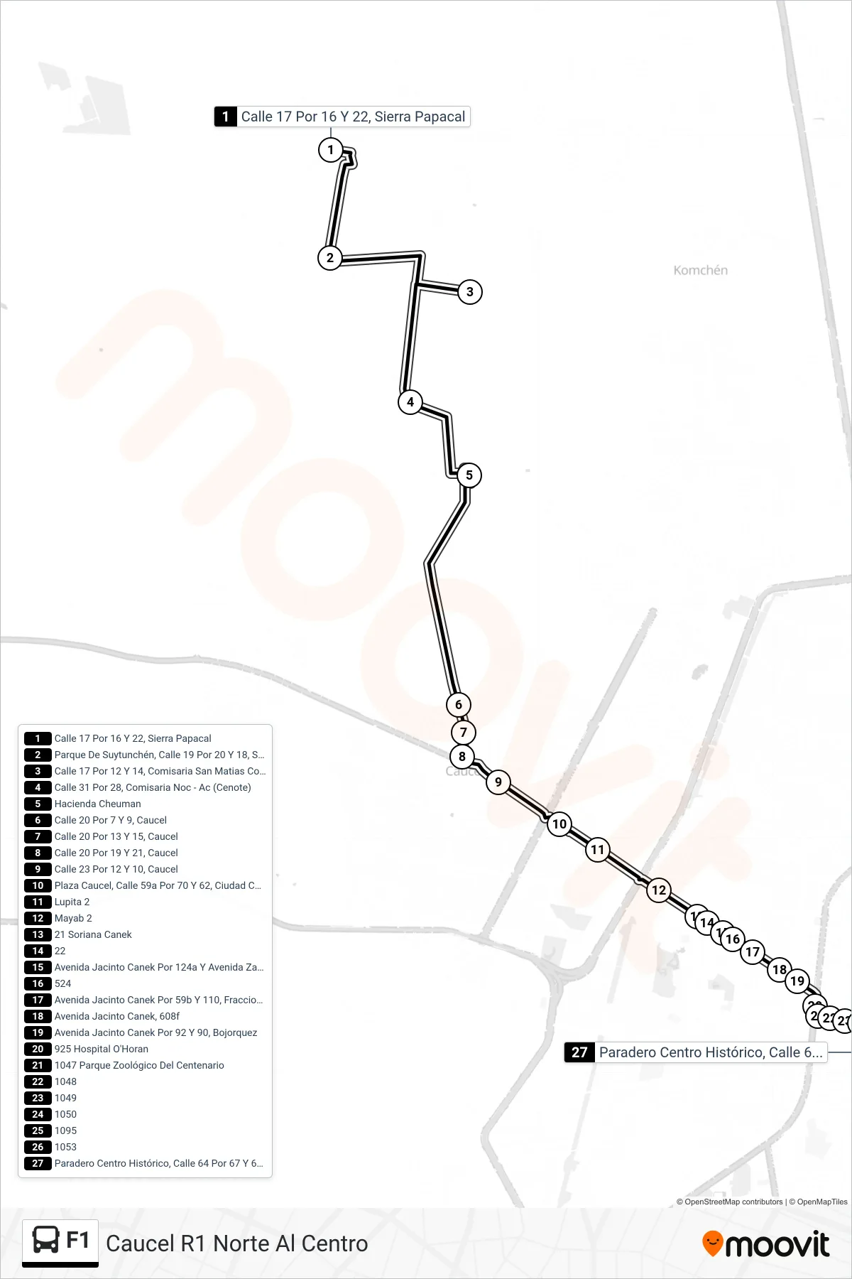
Stops list (F1 - Caucel R1 Norte Al Centro)
- Calle 17 Por 16 Y 22, Sierra Papacal
- Parque De Suytunchén, Calle 19 Por 20 Y 18, Suytunchén
- Calle 17 Por 12 Y 14, Comisaria San Matias Cosgaya
- Calle 31 Por 28, Comisaria Noc - Ac (Cenote)
- Hacienda Cheuman
- Calle 20 Por 7 Y 9, Caucel
- Calle 20 Por 13 Y 15, Caucel
- Calle 20 Por 19 Y 21, Caucel
- Calle 23 Por 12 Y 10, Caucel
- Plaza Caucel, Calle 59a Por 70 Y 62, Ciudad Caucel
- Lupita 2
- Mayab 2
- 21 Soriana Canek
- 22
- Avenida Jacinto Canek Por 124a Y Avenida Zamná, Yucalpetén
- 524
- Avenida Jacinto Canek Por 59b Y 110, Fraccionamiento Yucalpetén
- Avenida Jacinto Canek, 608f
- Avenida Jacinto Canek Por 92 Y 90, Bojorquez
- 925 Hospital O'Horan
- 1047 Parque Zoológico Del Centenario
- 1048
- 1049
- 1050
- 1095
- 1053
- Paradero Centro Histórico, Calle 64 Por 67 Y 65, Centro