
F2 Bus Route Map
View the F2 route map and see all F2 stops along the route. The map of F2 shows where the bus travels and the location of each stop, making it easy to understand the entire route at a glance.
Explore Autobuses routes on the map and see where Autobuses bus services operate. Use the F2 map to find bus stops and see how the F2 connects different areas along its trip.
All F2 stops on the map are displayed in route order, helping you follow the F2 bus from the first stop to the last.
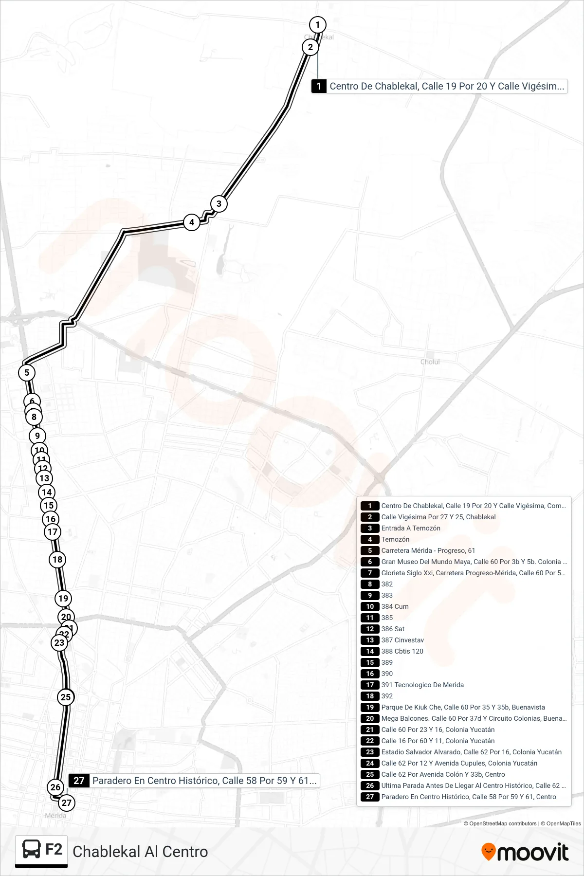
Stops list (F2 - Chablekal Al Centro)
- Centro De Chablekal, Calle 19 Por 20 Y Calle Vigésima, Comisaría De Chablekal
- Calle Vigésima Por 27 Y 25, Chablekal
- Entrada A Temozón
- Temozón
- Carretera Mérida - Progreso, 61
- Gran Museo Del Mundo Maya, Calle 60 Por 3b Y 5b. Colonia Revolución
- Glorieta Siglo Xxi, Carretera Progreso-Mérida, Calle 60 Por 5b, Montes De Amé
- 382
- 383
- 384 Cum
- 385
- 386 Sat
- 387 Cinvestav
- 388 Cbtis 120
- 389
- 390
- 391 Tecnologico De Merida
- 392
- Parque De Kiuk Che, Calle 60 Por 35 Y 35b, Buenavista
- Mega Balcones. Calle 60 Por 37d Y Circuito Colonias, Buenavista
- Calle 60 Por 23 Y 16, Colonia Yucatán
- Calle 16 Por 60 Y 11, Colonia Yucatán
- Estadio Salvador Alvarado, Calle 62 Por 16, Colonia Yucatán
- Calle 62 Por 12 Y Avenida Cupules, Colonia Yucatán
- Calle 62 Por Avenida Colón Y 33b, Centro
- Ultima Parada Antes De Llegar Al Centro Histórico, Calle 62 Por 55 Y 57, Centro
- Paradero En Centro Histórico, Calle 58 Por 59 Y 61, Centro