
FAIR HAVEN Bus Route Map
View the FAIR HAVEN route map and see all FAIR HAVEN stops along the route. The map of FAIR HAVEN shows where the bus travels and the location of each stop, making it easy to understand the entire route at a glance.
Explore The Bus (Marble Valley Regional Transit District) routes on the map and see where The Bus (Marble Valley Regional Transit District) bus services operate. Use the FAIR HAVEN map to find bus stops and see how the FAIR HAVEN connects different areas along its trip.
All FAIR HAVEN stops on the map are displayed in route order, helping you follow the FAIR HAVEN bus from the first stop to the last.
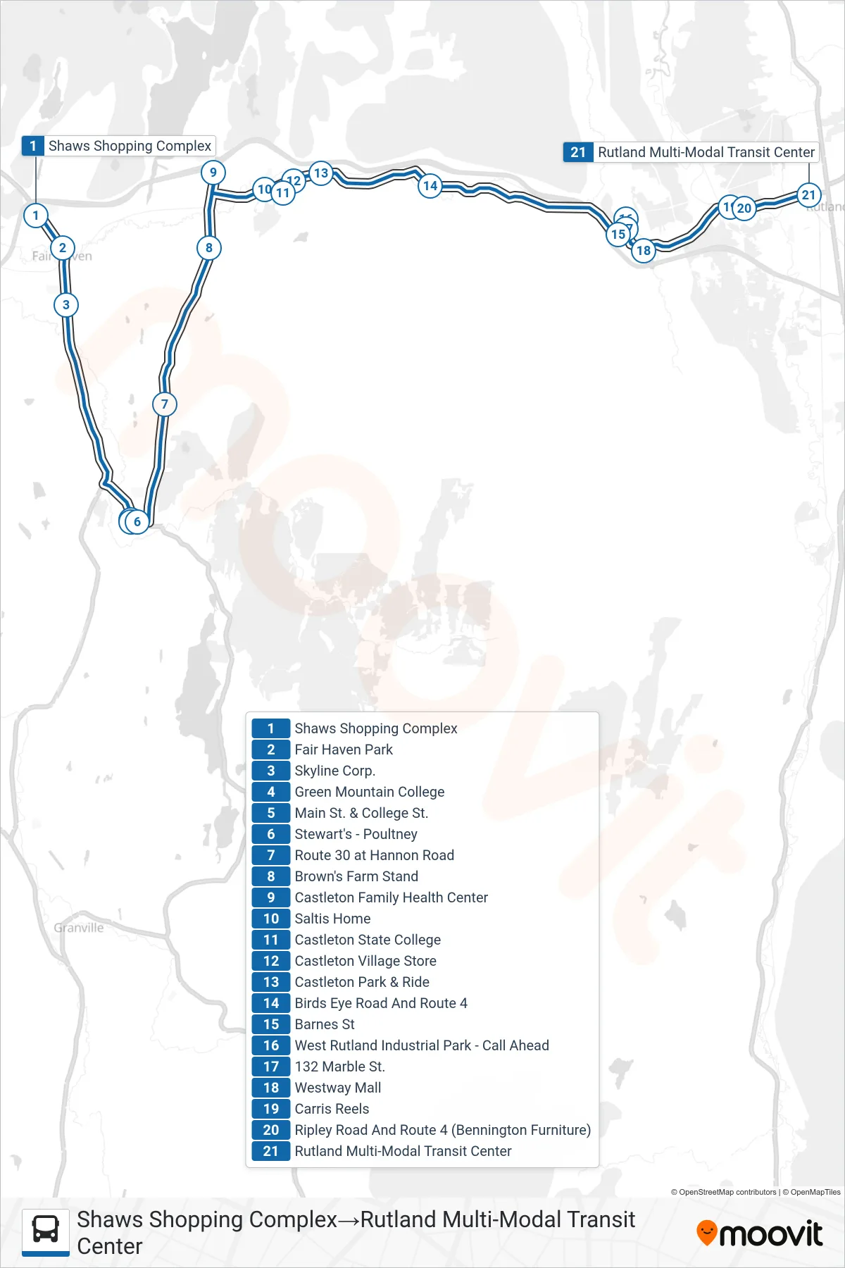
Stops list (FAIR HAVEN - Shaws Shopping Complex→Rutland Multi-Modal Transit Center)
- Shaws Shopping Complex
- Fair Haven Park
- Skyline Corp.
- Green Mountain College
- Main St. & College St.
- Stewart's - Poultney
- Route 30 at Hannon Road
- Brown's Farm Stand
- Castleton Family Health Center
- Saltis Home
- Castleton State College
- Castleton Village Store
- Castleton Park & Ride
- Birds Eye Road And Route 4
- Barnes St
- West Rutland Industrial Park - Call Ahead
- 132 Marble St.
- Westway Mall
- Carris Reels
- Ripley Road And Route 4 (Bennington Furniture)
- Rutland Multi-Modal Transit Center